Humans have developed remarkable adaptations to live in extreme environments, as demonstrated by seven unique villages worldwide: Kandovan (Iran) where people live inside volcanic rock formations, Githoorn (Netherlands) where canals replace roads, the Korowai Tribe (Papua New Guinea) who build tree houses 40 meters above ground, the Bajau Sea Nomads (Philippines/Malaysia) who have evolved larger spleens for deep diving, the Uros Floating Islands (Peru) made entirely of reeds, Ushguli (Georgia) isolated for 6 months annually by snow, and Setenil de las Bodegas (Spain) built under rock overhangs. These examples show that human settlement choices are not accidental but deliberate adaptations to local geography, climate, and resources.
Install our extension to search inside any video instantly.
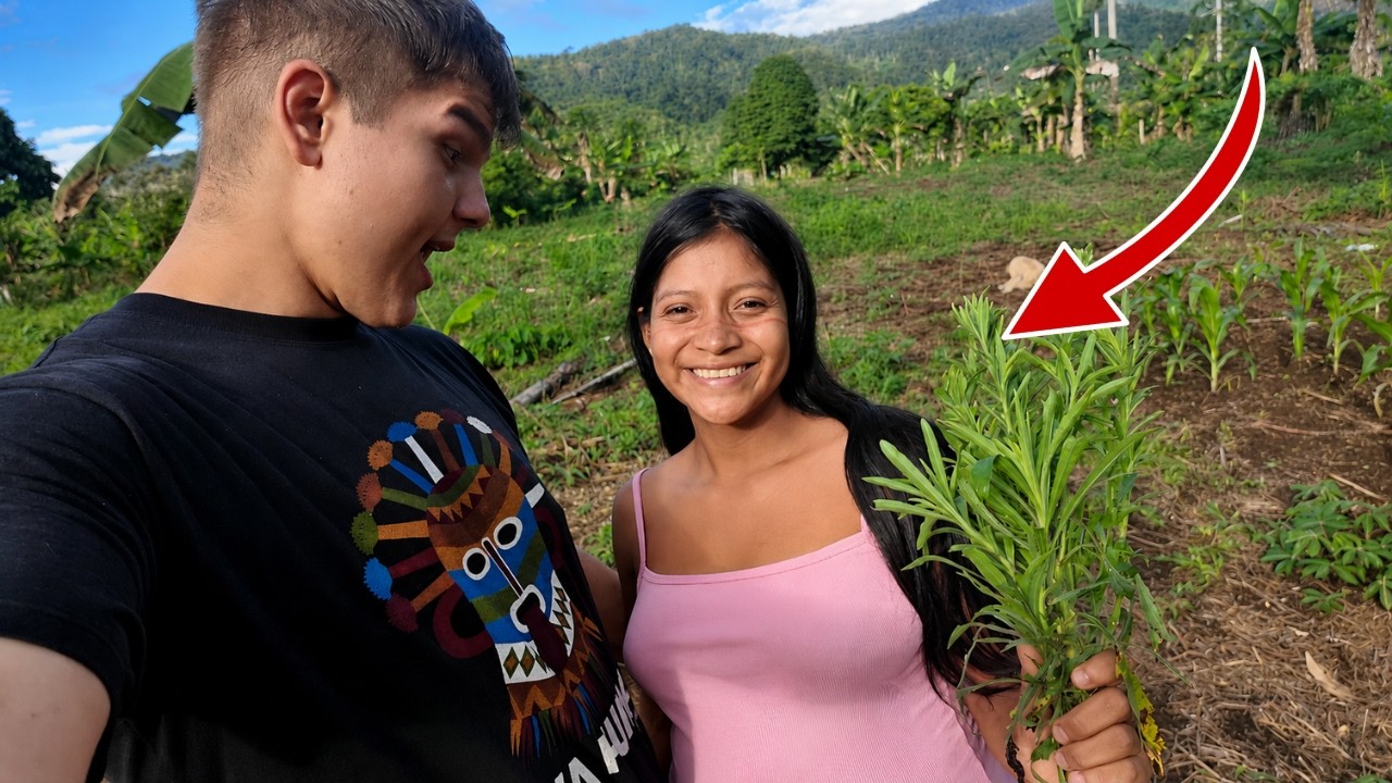
IMPOSSIBLE PLACES | Extreme Villages Where People Still Live Today!Added:
Where do you live?
An apartment, a house, a street with a number, a city with a name.
Now, forget all of that because somewhere on this planet right now, someone is walking out of their front door and stepping onto water.
Not land, water.
Someone else is climbing a ladder 40 m into the air to reach their bedroom.
Someone else has never needed a road.
Has never owned a car. Has never needed to.
And someone else lives inside a rock.
Not near a rock. Inside one.
These are not survival stories. These are not emergencies. These are homes.
chosen, built, lived in for generations.
Seven places. Seven answers to the question. What does it mean to call somewhere home?
Kandavan, Iran.
From a distance, it looks like a termite mound or a hive. or something that was grown rather than built.
Hundreds of cone-shaped rocks, each one with a door, a window, a chimney, smoke rising from the top.
These are not decorations.
These are not tourist attractions.
People live in them, have lived in them for 700 years.
in homes carved from volcanic rock from the inside out.
Kandovan in the East Azerbaijan province of Iran. A village built into a field of Koranga. Volcanic rock formations created by the eruption of Mount Sahand 7,000 years ago.
The lava cooled, the ash compressed, the rain and wind carved the softer stone into these cone shapes. Each one slightly different, each one hollow at the core.
And someone 700 years ago looked at these cones and thought, "Door here, window there, room inside."
The homes have multiple floors. Ground floor for animals, middle floors for living, upper floors for storage.
All carved upward through the rock, connected by internal staircases cut from the stone itself.
The rock regulates the temperature. Cool in summer, warm in winter. No air conditioning needed, no heating system.
The rock does both as it has done for 700 years.
The village is still inhabited, the same families, the same carved homes. Some have added modern doors, satellite dishes, electricity cables running up the outside of cones that were carved by hand 700 years ago.
Old and new, stone and satellite.
A village that solved the problem of temperature seven centuries before air conditioning existed.
by moving into a rock and calling it home.
Githhorn, Netherland.
There are no roads here. Not closed roads, not broken roads, no roads.
Githorn, a village in the over ISIL province of the Netherlands, has no roads connecting its houses. Never has.
The only way to move through this village is by water, >> by the 7 km of canals that wind between the islands on which the houses sit.
Flat bottomed boats called punters pushed by a pole. Silent, no engine, no noise, just the sound of water and bird song and the occasional voice from a garden.
>> Scenic canals.
The village was founded in the 13th century by fugitives.
People running from persecution who settled in a remote marshy area that nobody else wanted.
They dug Pete for fuel. The Pete digging created trenches. The trenches filled with water. The water became canals. The canals became the roads.
And they never built actual roads because they didn't need to. The canals worked.
Today, Gethhorn has around 2,600 residents, all of them accessed by boat.
The postman delivers by boat. The doctor visits by boat. Groceries arrive by boat. Guests come by boat.
The bridges here, some 176 of them, are for pedestrians only. No vehicle has ever crossed them because no vehicle has ever needed to.
In summer, the canals fill with tourist boats. Everyone moving slowly, everyone quiet because the village requires it.
No engines above a certain speed, no noise above a certain level.
A rule enforced not by law, but by the village itself, by its canals, by its silence.
arrive here on a winter morning before the tourists. When the canals are still, when the thatched farmhouses reflect in the water, when the only sound is the water and the birds and understand why someone who arrived here 700 years ago and found this marsh decided to stay and never build a road.
Cororoai tribe, Papua New Guinea.
The ladder is 40 m long. That is where the door is. 40 m above the forest floor, above the roots, above the mud, above the insects and the animals and the other tribes that the Cororowai have been hiding from for centuries.
The Cororai people of the remote rainforest of southeastern Papua New Guinea build their homes in trees.
Not small homes, full-size family homes with multiple rooms, a cooking area, a sleeping area, storage, all 15 to 50 m above the ground.
built from the tree itself.
From the wood and bark and leaves of the tree that holds the house. The platform attached to the trunk. The walls woven from bark. The roof thatched with leaves.
Everything from the tree supported by the tree 40 m in the air.
The Cororoai had no confirmed contact with the outside world until 1974.
Missionaries reached them and found a people who believed that outsiders were demons called Kakqua who came in human form and had to be killed.
Trust took decades and is still fragile.
The tree houses exist for protection from floods. The forest floods seasonally from insects, from predators, from rival groups.
At 40 m, you are above almost all of these threats.
The children climb from the moment they can walk 40 m on a notched pole barefoot without falling, without thinking about it. The way other children cross a street.
There are an estimated 4,000 Korawaii people, most still living in tree houses, most still above 30 m.
The forest below them is exactly as it was a thousand years ago because they live above it and leave it alone.
Baja sea nomads, Philippines/Malaysia.
They are born on the water. They live on the water. They die on the water.
And the water has changed them.
The Baja people, called the Sea Nomads, have lived on and in the ocean off the coasts of the Philippines, Malaysia, and Indonesia for over 1,000 years.
Some live on boats, some in stilt houses built directly over the sea, villages floating above coral reefs, walkways connecting house to house, over open water. The reef visible directly below through the gaps in the planks.
>> The children swim before they walk. Some never learn to walk properly because they spend so much time in the water.
The Baja dive for food. Free dive. No tanks, no equipment. holding their breath down to 60 m for up to 13 minutes.
That is not a normal human capacity.
The world record for competitive free diving is around 24 minutes. The Baja achieved 13 minutes while working, while hunting, while carrying spears.
Science wanted to know how.
In 2018, researchers discovered that the Baja spleen is 50% larger than average.
The spleen stores oxygenated blood cells. A larger spleen means a larger oxygen reserve. When the Baja dive, their spleen contracts, releasing extra oxygenated blood, extending the dive.
The ocean changed their organs. Over 1,000 years of diving, natural selection favored larger spleens. The Baja evolved specifically for the sea.
Some Bajao deliberately perforate their eardrums as children to improve pressure equalization during deep dives.
They choose pain for the ability to go deeper.
When Baja people spend time on land, many describe feeling unwell, dizzy, uncomfortable.
They call it land sickness. The opposite of seasickness for people who were built for the water.
Euros floating islands, Peru.
The island beneath your feet is not land. It is reads. Totora reads.
layered 3 m thick, floating on Lake Tittikaka at 3,810 m above sea level and you are sinking slowly as you stand on it. The reeds compressing under your weight.
The island is alive. It is rotting from the bottom. The lowest reeds decompose in the lake water.
And so the Euros people, who have lived on these islands for over 500 years, add new reeds to the top every single day, replacing what the water takes, building upward as the bottom dissolves.
an island that must be constantly rebuilt just to stay afloat.
There are 42 of these islands on Lake Titikaka near Puno, Peru. Home to around 2,000 people, all floating, all made entirely of reeds.
Not just the island. The houses reads, the boats reads, the watchtowers reads, the furniture reads, even some of the food, the soft white core of the tora reed, is eaten raw.
A slightly sweet, starchy vegetable that grows directly beneath where they sleep.
The Uros originally built floating islands to escape the Inca Empire and before that to escape the Imara people.
Islands that could be moved were islands that could not be found or attacked or taxed.
When enemies came, they cut the anchor ropes and floated away.
That option still exists. The islands are still anchored with ropes tied to poles driven into the lake bottom. Every island can be untied and moved in an afternoon.
A civilization that solved the problem of being conquered by making its entire homeland mobile.
Today, the Euros maintain their traditional life. They fish, they hunt birds, they make crafts from reeds. Some welcome tourists onto their islands.
The tourists step onto the island and feel it flex under their feet. Feel the water below. Feel the island breathing.
and understand what it means to build your home on something that is always moving Georgia.
In October, the road disappears. Not closes, not becomes dangerous.
Disappears under snow. under meters of snow until April.
And the 200 people who live in Oshkulli, the highest permanently inhabited village in Europe, are on their own.
No supply trucks, no doctors, no emergency services, no way in, no way out.
Everything they need for 6 months of winter must be stored before the first snowfall. Food, medicine, fuel, everything calculated precisely.
Because if you miscalculate, there is no going to the shop. There is no ordering online. There is only what you have and the snow and the months.
Ushgouli sits at 2,200 m in the Cauus Mountains of Georgia. The Angori River runs below it.
The Skara Glacier, the highest peak in Georgia, rises above it.
Around the village, more than 200 stone towers built between the 9th and 12th centuries by individual families as refugees during clan wars.
Each family owned their own tower. When enemies came, the ladder came up, the doors sealed. The family waited inside, sometimes for weeks.
The towers have no ground level entrance. You entered from the second floor by ladder which you pulled up behind you.
Today, those same towers still stand.
The same family still own them. passed down through 30 generations.
In summer, a dirt road connects Ushgouli to the nearest town. 40 km, 2 hours in a 4x4, impassible in rain.
A child born in Nushkuli in November may not leave the village until they are 6 months old. Not because no one wants to take them, because there is no way.
The village has been continuously inhabited for over 1,000 years.
through every winter, every isolation, every 6 months of being entirely on their own.
They stayed every time.
Satanil de lasodeas, Spain.
The roof of this house is not tiles.
Not slate, not concrete.
It is a cliff, a solid overhang of rock that has been the ceiling of this street for 500 years. That was here before the houses were built beneath it. That will be here long after.
Settil de lasas bodeas a small town in Andalusia Spain built directly into the gorge carved by the treasure river.
The river cut through soft rock over thousands of years. Left overhangs left caves left protected ledges where the sun never quite reaches and the temperature stays constant.
And people moved in, not into caves.
They built proper houses.
Whitewashed walls, wooden doors, flower pots, window boxes, all under a ceiling of solid rock that weighs thousands of tons above their heads.
The rock keeps the houses cool in summer. The same rock that makes the summers brutal in the rest of Andalusia 40° in the shade. Here the shade is permanent, built into the geology itself.
There are two main streets running under the overhang.
Calvas del Soul. Callequas de la Sombra.
The street of the sun caves. The street of the shadow caves. Named for which side of the rock the sun reaches.
Restaurants operate under the overhang.
Bars, shops.
People eat lunch under a ceiling of stone.
with a view down the gorge to the river below.
The town has been here since before recorded history. The Romans were here.
The Moors were here. The Spanish reconista tried to take it seven times before they finally succeeded.
Because a town built under a rock is very difficult to attack.
The rock is the wall. The rock is the ceiling. The rock is the reason this town still exists.
500 years of living under something that could fall and hasn't.
Seven places. Seven different answers to the same question. Where do you live?
On reads floating above a lake.
On the sea itself, in trees 40 m above the ground, inside of volcanoes left over rock.
in canals instead of streets.
Under a cliff that is your ceiling in a village cut off from the world for half the year.
What connects all of them is not the place, it's the decision.
Someone looked at a reed lake and decided here. Someone looked at a tree and decided up there.
Someone looked at a rock and decided inside.
Not by accident, not by necessity, by choice.
The strangest homes on Earth are strange only to those of us who chose differently. Subscribe because there are more of these places than you can imagine.
There are places on this planet that most people will never see.
Not because they're dangerous. Not because they're expensive.
Not because they're secret.
Because most people don't know they exist.
The maps are complete. Every corner of the earth has been photographed from space. Every mountain named. Every river traced.
And still the planet hides things.
Places so extraordinary that when you finally see them, the only thought you have is, "How did I not know about this?"
14 of them waiting.
Sandwich Harbor, Namibia.
Look at this image. Your brain tells you it's wrong.
On the left, the Atlantic Ocean. Waves crashing, cold, gray, enormous.
On the right, the Namib Desert, the oldest desert on Earth.
Sand dunes 300 meters tall, burning orange, bone dry.
And in the middle, nothing. No beach, no gradual transition.
The dunes simply end at the waterline.
Orange sand falling directly into gray ocean.
Sandwich Harbor on the coast of Namibia, where two of Earth's most extreme environments collide without warning, without compromise, without either one giving way.
The dunes here are among the tallest in the world. Some reach 300 m.
And they move every year. Pushed by the wind. The dune field advances toward the sea. The ocean pushes back.
Neither winds. The border shifts.
Sometimes the dunes advance. Sometimes the sea claims them back.
The landscape changes every single day.
Flamingos feed in the shallow lagoon where fresh water seeps through the base of the dunes. Seals swim in the surf 20 m from dry sand.
Pelicans dive where desert meets ocean at the exact point where one world ends and another begins.
There is no road here. You reach it by 4x4 across the dunes themselves or by boat. The access closes daily with the tide.
Most people who visit Namibia never come here. Most people who come here cannot believe what they're looking at.
Sotra Island, Yemen.
It looks like someone drew trees who had never seen a tree.
A thick trunk, then nothing. Then at the very top, a flat umbrella of branches, like a mushroom, like something from a Dr. Seuss book like a tree designed by someone who understood the concept but missed all the details.
These are dragon blood trees. They exist on one island in the Indian Ocean, Satra, and almost nowhere else on Earth.
The island has been isolated for so long, cut off from the Arabian Peninsula by rising seas millions of years ago, that 37% of its plant species exist nowhere else on the planet.
Not similar species, not related species, not found anywhere else at all.
The dragon blood tree gets its name from its sap. Cut the bark and it bleeds red.
Deep crimson red.
Used for centuries as medicine, as dye, as violin varnish, as a magical substance by people across the ancient world who had no idea where it came from.
They knew it was Sucatra.
They just couldn't get there.
The island sits in the path of the Indian Ocean monsoon.
For 3 months every year, it is completely cut off.
No boats can land. No planes can fly.
The island disappears behind walls of wind and rain and becomes entirely itself again.
The people who live here have a language spoken by no one else on Earth, a face that is distinct, a culture built around this specific island and no other.
There are 60,000 of them living on an island that looks like it belongs on another planet.
Saler Deuni, Bolivia.
In the wet season, it rains on the salt flat. A thin layer of water a few centimeters deep covering 10,582 km of pure white salt and the result is the largest mirror on Earth.
The sky reflects perfectly. Every cloud, every color at sunrise, every star at night.
You stand on it and you cannot see where the ground ends and the sky begins.
Above you, sky. Below you the same sky.
In every direction, sky.
You are not standing on the ground. You are standing inside the sky.
Salar Deu Yuni in the Aliplano of Bolivia, 3,656 m above sea level. The largest salt flat in the world, a prehistoric lake that dried up 10,000 years ago, leaving behind 11 billion tons of salt.
In the dry season, the surface is pure white, cracked into perfect hexagonal tiles as far as the eye can see.
The same geometry as the giant's causeway, the same mathematics, just salt instead of basalt and 10,582 km instead of a coastline.
In the middle, Isla Inkahasi, a coral island that was once the seafloor of the prehistoric lake, now surrounded by salt instead of water.
covered in cacti some over 1,200 years old.
Growing 1 centimeter per year, standing 10 m tall on an island of coral in a desert of salt at 3,600 m altitude.
Nothing about this place follows the rules.
Straer Geyser, Iceland.
Every 8 minutes, the ground exhales.
A column of boiling water shoots 30 m into the air. Just like that, without warning, without buildup.
One moment, a calm blue pool. The next an explosion of steam and water that reaches the height of a 10-story building.
Then silence.
Then the pool refills. Then 8 minutes later again.
Strakur in the Halcadal geothermal area of Iceland. One of the most reliably erupting geysers on Earth.
A geyser is not a hot spring. It is a very specific system. A deep crack in the earth filled with water.
The bottom of the crack touching superheated rock.
The water at the bottom reaching 120° C but unable to boil because of the pressure of all the water above it until something shifts.
A tiny change in pressure and the superheated water flashes instantly to steam.
expanding to 1,500 times its volume in a fraction of a second, forcing everything above it up and out.
30 m into the air in less than a second from a pool that was calm a heartbeat before.
The word geyser comes from the old Norse word gisa to gush named for the great geyser nearby. The geyser that gave all geysers their name.
Iceland sits on the mid-Atlantic ridge, the exact line where the North American tectonic plate and the Eurasian tectonic plate are pulling apart.
At the rate your fingernails grow, every year Iceland gets slightly wider and the geothermal activity that powers Straur gets slightly more intense.
8 minutes, then 30 m, then silence, then 8 minutes.
The earth breathing on a schedule whether anyone is watching or not.
Antelopee Canyon, Arizona, USA.
At noon on certain days, a beam of light falls into the canyon.
Not scattered light, not ambient glow. A single beam straight down through a crack in the sandstone 20 m above, landing on the canyon floor like a spotlight, like something placed deliberately by someone.
The walls of Antelopee Canyon flow like water. Smooth curves, deep orange and red. Layer after layer of sandstone worn by flash floods over millions of years into shapes that look sculpted by human hands.
But they weren't. They were sculpted by water rushing through this narrow crack every monsoon season.
For millions of years, wearing the rock smooth, cutting deeper, leaving curves where you would expect only angles.
The canyon is barely wide enough to turn around in. In some sections, you can touch both walls with your arms outstretched.
And above you, the sandstone narrows further. A strip of sky sometimes only a meter wide.
At midday in summer, when the sun is directly above, the light drops through that strip and the effect is electric.
The beam is visible.
You can see it as a solid column of light standing in the dark canyon.
The Navajo call this place say Biganilini, the place where water runs through rocks. They have known about it for centuries.
Tourists found it in the 1990s.
Now it requires a permit and a Navajo guide. You cannot enter alone because the same flash floods that carve these walls still happen every monsoon.
The canyon can fill in minutes with no warning from above.
the most photographed canyon in the American Southwest and one of the most dangerous both at the same time.
Land Manaler Iceland.
They look like they've been painted.
Specifically, like someone with too many colors and not enough restraint painted them.
Yellow sulfur mountains, pink riolyte ridges, green mossy slopes, black lava fields, red iron stained gullies, all in the same view. All touching, all real.
land mana logger in the highlands of Iceland, a geothermal area where the ground is warm to the touch and hot springs bubble from the base of the hills.
The colors come from chemistry. Each mineral leaves a different stain on the rock.
Sulfur yellow, iron oxide red, chlorite green, riolyte itself pink and gray.
The lava field at the entrance is 500 years old. Still black, still sharp, still so raw it looks like it cooled last week.
Walk across it toward the hills and the landscape changes every 100 meters.
Black to green, green to yellow, yellow to pink.
A color palette that makes no geological sense until you understand that every color is a different mineral at a different temperature at a different depth.
In summer, hikers come here to walk the Laave Trail 55 km through this landscape.
Across the lava, through the hot springs, over mountain passes where the ground steams and every footstep sounds different on different ground.
In winter, it is completely unreachable, buried under snow, accessible only by snowmobile to those who know exactly where they are going.
A place that looks painted because it is by 10 million years of volcanic chemistry.
Skeleton Coast, Namibia.
The San Bushmen called it the land god made in anger.
The Portuguese sailors called it the gates of hell.
The Namibian government simply named it the skeleton coast for good reason.
This 500 km stretch of the Namibian coastline is one of the most dangerous stretches of ocean in the world.
Cold Benua current meets warm tropical air.
The result, permanent thick fog for most of the year, day and night.
Ships navigating by sight see nothing.
They think they are in open water. Then they hit sand. Then the waves pin them and the fog doesn't lift. And there is no rescue because there is no road.
The skeletons are everywhere.
Rusting hulls half buried in sand dunes.
Some from the 1800s.
Some from the 1900s.
some from recent decades.
All in various states of being swallowed by the Namib Desert.
The desert claims them slowly. Sand fills the cabins. Dunes bury the boughs.
Seals colonize the hulls.
Until a ship that carried cargo and crew becomes just another feature of a coastline that has been consuming ships for centuries.
Brown hyenas patrol the beaches.
Blackbacked jackals pick through seal colonies.
Lions, the skeleton coast lions, the only desert lions on Earth, wander the dunes, hunting seals hundreds of kilometers from any water in a desert.
It is one of the most inhospitable places on earth and one of the most extraordinary The bones are real. The ships are real.
The lions are real.
Plit Vice Lakes, Croatia.
Most lakes are dug by glaciers, by rivers, by the slow, patient work of water and gravity over millions of years.
The Plitfist lakes built themselves 16 lakes connected by waterfalls. Each waterfall flowing from one lake to the next, descending through a valley in a staircase of turquoise water that drops 133 m from the highest lake to the lowest.
The water here is saturated with calcium carbonate.
As it flows, it deposits that calcium carbonate on every surface it touches.
Mosses, algae, fallen branches, all coated, all slowly turning to stone.
This is travertine, the same material as the coliseum in Rome, as Pameala in Turkey forming here continuously right now.
The barriers between the lakes, the natural dams that hold the water back, are made entirely of this travertine, built by the water itself.
Over thousands of years, the water created the barriers. The barriers created the lakes. The lakes feed the waterfalls.
The waterfalls build more barriers. The system builds itself and has been building itself for 12,000 years.
The color of the water changes with the light, with the season, with the minerals in the water. at any given moment.
Green, blue, gray, azure, sometimes all in the same lake at the same time.
You walk through it on wooden boardwalks suspended above the water, sometimes above the waterfalls themselves, the mist rising from below.
The sound of falling water in every direction.
Fish visible through the surface as if through glass.
A place that is still building itself right now while you walk through it.
Dead. Vle sauces. lay Namibia.
The trees died in 1340. The dunes shifted. The river that fed the clay pan was cut off.
The water stopped and the trees camelthorn acacas died.
and then stayed. 900 years later, they are still standing, black against the white clay, against the orange dunes, against the blue sky.
In the Namib Desert, the oldest desert on Earth, the air is so dry that the dead wood cannot rot.
There is no moisture for the bacteria, no moisture for the fungi, nothing to break the wood down.
So it stands. 900-year-old skeletons in a white clay pan called Dead Vle surrounded by the tallest sand dunes in the world. Some reaching 300 m.
The contrast is absolute. White clay, black trees, orange dunes, blue sky.
Four colors, nothing else. No gradation, no softness. Each element in its purest form.
From above, it looks like a painting, not a landscape. A painting. Too stark, too geometric, too perfectly composed to be accidental.
But it is accidental. It is geology and climate and a river that changed course 900 years ago.
The white clay cracks in perfect patterns under the heat. The black trees cast shadows that move across the white as the sun moves.
The dunes shift millime per day pushed by the wind.
Everything here is moving. The trees are the only things that stopped 900 years ago and haven't moved since.
Pami, Turkey.
From a distance, it looks like snow. A white hillside in the middle of a dry Turkish landscape.
Get closer and it looks like ice. Frozen waterfalls, white terraces cascading down the hillside.
Touch it and the water is warm. 36° C like a bath.
In bright blue pools on the edge of a cliff in the middle of a country where it almost never snows.
Pomacle cotton castle in Turkish. a hillside in the Denisle province of western Turkey where thermal springs have been depositing calcium carbonate for 14,000 years.
The water emerges from the ground at 35° saturated with dissolved calcium carbonate.
As it flows down the hillside, exposed to air, the carbon dioxide escapes and the calcium carbonate crystallizes layer after layer for 14,000 years.
The result, 17 km of white terraces.
Some the size of swimming pools filled with warm turquoise water.
Others dry pure white stone that looks like snow but feels like smooth ceramic.
At the top of the terraces, the ancient city of Hierropolis, a Roman spa city built 2,000 years ago directly on top of these springs because even the Romans couldn't resist.
The Necropolis of Hierapoulos is one of the largest ancient cemeteries in the world.
1,200 tombs over 2 kilometers long because people came here sick and some of them didn't make it back. White terraces, warm water, ancient ruins, and 14,000 years of the earth slowly painting a hillside white.
Fagradal's Jaw volcano eruption, Iceland.
In March 2021, a volcano erupted in Iceland that had been dormant for 800 years.
Not a violent eruption, not an explosion. A crack opened in the earth.
And lava simply began to pour out like a wound, slow and inevitable, glowing orange in the dark, moving at walking pace across the black landscape.
And people walk toward it, not running away, walking toward it. Because in Iceland, this is what happens. The population of a country that lives on a volcano treats eruptions as events to attend.
They hiked to the eruption site, thousands of them, every day.
standing 50 m from flowing lava, feeling the heat on their faces, watching the earth being made in real time.
This is the thing about lava that photographs don't convey. It is slow. It moves like thick honey. You can watch it advancing centimeter by centimeter.
You can see individual rocks being swallowed, individual plants igniting.
You can watch the earth growing because that is what lava is, new land.
The interior of the Earth reaching the surface, cooling, becoming something solid, something that will still be there in a million years.
Vagrad doll erupted again in 2022 and 2023 and 2024.
The volcano woke up and decided to stay awake.
The lava field it has created covers four square kilm. All of it new land.
Land that didn't exist 4 years ago.
The earth making itself while people watch.
Iguazu Falls, Argentina/B Brazil.
Elellanena Roosevelt visited Niagara Falls. Then she visited Iguazu.
Her response, poor Niagara.
Iguazu Falls is not one waterfall. It is 275 waterfalls, spread across 2.7 km of the Iguazu River, where the river drops off the edge of a basalt plateau into a canyon below.
Not all at once. in a horseshoe in a curb.
So that when you stand at the center of the horseshoe, the water is falling in front of you and to your left and to your right in every direction.
You are surrounded by waterfall.
The largest single drop, the Devil's Throat, 82 m, 150 m wide.
The spray it generates rises 150 m into the air permanently.
A cloud that never disperses, visible from kilome away.
In the wet season, Iguazu carries more water than any other waterfall system on Earth, more than Victoria Falls, more than Niagara, 12,000 cub m/ second, every second.
The Brazilian side gives you the panoramic view, the entire 2.7 km, every waterfall at once.
The Argentine side puts you inside it.
On walkways above the water, on platforms over the edge, at the devil's throat, looking directly down into the white chaos.
The sound so loud you can't hear the person standing next to you. Both sides are correct. You need both.
to understand what 275 waterfalls falling simultaneously for thousands of years actually looks like from every angle.
Chocolate Hills, Philippines.
There are 1,776 of them.
across 50 square kilometers of Bohal Island in the Philippines.
All roughly the same size, all roughly conicle, all covered in grass, all turning brown in the dry season, the color of chocolate, giving them their name.
1,776 hills all the same from horizon to horizon as far as you can see.
And nobody fully understands how they formed.
the leading geological theory. They are ancient coral formations, limestone deposits from a time when this area was under the sea.
The sea retreated. The limestone was exposed. Rain dissolved the softer parts, left the harder cores. The cores became hills.
But that doesn't explain why they are all roughly the same size, why they are so regularly spaced, why the pattern is so consistent across 50 square kilm.
Natural processes don't usually produce this kind of regularity.
This kind of repetition, this kind of order.
The local legend is simpler. Two giants had a fight. They threw rocks and sand at each other for days, then made peace and left.
The piles they left behind became the hills.
At sunrise, when the low light hits the hills from the side, the shadows between them make the entire landscape look three-dimensional, like a topographic map come to life.
From the air, the regularity is even more striking. Hill after hill after hill in every direction, perfectly even, perfectly spaced, as if placed, by giants or by geology. Both answers raise more questions than they answer.
Jang Yaangia Rainbow Mountains, China.
The first time most people see them, they assume the photograph has been edited.
The colors are too many, too saturated, in the wrong places.
Red, orange, yellow, green, blue, purple, all in the same mountain in horizontal stripes. Like a painting, not a landscape.
They are real. They have never been edited.
The Danga Denia in Gansu Province, China. What geologists call red geology.
Layers of sandstone and minerals deposited over 24 million years as sediment in an ancient lake. Iron oxide red and orange. Chlorite green.
Manganese purple. Sulfur yellow.
Each layer a different period, a different mineral, a different color.
Then 10 million years ago, the tectonic collision that created the Himalayas lifted and tilted this entire region.
The flat horizontal layers became angled, exposed at the surface, and the rain began revealing them. The colors change with the light.
At dawn, pale and pastel.
At noon, vivid and electric. At sunset, deep and saturated.
After rain, every color intensified, every stripe more defined, more impossible.
14 places, all of them real. All of them on this planet. All of them waiting.
A desert that meets an ocean with nothing between them.
An island with trees that exist nowhere else.
The largest mirror on Earth.
A gazer on a schedule.
A canyon that catches sunlight like a laser.
Mountains painted by 10 million years of chemistry.
A coastline of bones and broken ships.
Lakes that build themselves.
Trees that died 900 years ago and refused to fall.
White terraces in the middle of a desert.
A volcano. who you can walk to a waterfall that surrounds you.
Hills that nobody can explain.
Mountains of impossible color.
The planet is 4.5 billion years old.
We have been paying attention for almost none of that time.
And this is what we found so far.
Subscribe because we haven't stopped looking.
Related Videos
She Taught Me What Most Americans Will Never Learn
JustinAlvo
259 views•2026-06-03

Native Americans in Pacific Northwest preserve salmon fishing tradition for future generations
CBSMornings
719 views•2026-05-30

Before Castles: Discovering Portugal’s Colossal Chalcolithic Stronghold
prehistoricportugal
184 views•2026-05-29

5 Mistakes Americans Make in Australia That Australian Spot Instantly
Auzura-i2e
159 views•2026-05-29

“Much Larger Than Any Man Back Home” — German POW Women Compared American Cowboys to German Men
ForgottenFronts-d6q
2K views•2026-06-01

Americans Losing Their Minds In Europe..
camkirkhambabyy
54K views•2026-05-29

Discover the survival and hunting methods of the Hadzabe tribe — Cooking in the wildest way
hadzapeopledocumentary
507 views•2026-05-28

ETHIOPIA — The Most Misunderstood Country In East Africa?
ZiAfreen
165 views•2026-05-31


