This analysis correctly identifies that electronic subversion has become a more potent strategic tool than kinetic force in modern asymmetric warfare. By capturing assets intact, adversaries gain a permanent technological advantage that fundamentally shifts the global balance of power.
Install our extension to search inside any video instantly.
Iran CAPTURES US Drone Over Persian Gulf — Secret Payload Reveals Everything
Added:Tonight, I want to walk you through four questions that the mainstream defense commentary has spent years avoiding because the answers are deeply uncomfortable for everyone who spent the last decade assuring the public that Iran's drone program was a second rate imitation of real military capability.
First, how did Iran capture an American stealth drone in 2011 without firing a single shot? And what does the specific technical method it used tell us about electronic warfare capability that the United States is still struggling to counter today? Second, what was actually inside that drone? What did Iranian and subsequently Russian and Chinese engineers learned from it? And how did those lessons propagate through a decade of weapons development that produced systems currently being used against American and Israeli assets across the Middle East? Third, why has the Persian Gulf become the world's most intensive electronic warfare environment? And what does the documented pattern of GPS spoofing, signal jamming, and drone disruption that has unfolded across the straight of Hormuz reveal about Iran's current capability to neutralize the drone surveillance architecture that American military planners depend on?
And fourth, when you understand what has already been extracted from captured American systems and what Iran's electronic warfare program can now do in the airspace above the Persian Gulf, what does that tell us about the actual vulnerability of every surveillance asset the United States is flying in that region today? Stay with me because this analysis goes to the operational reality that Washington does not want acknowledged and that the mainstream defense media consistently underweights in its coverage of the Iran confrontation. Before we go any further, if you have been following this channel, you know we go where the evidence leads regardless of where that takes us. Hit like and subscribe right now so you do not miss what comes next because the story I'm about to walk you through changes the strategic picture in ways that most analysts are only beginning to absorb. Drop your assessment in the comments. I read them all and I want to know whether you think Washington has an honest answer to the capability gap I'm going to lay out in the next 40 minutes.
Let me start with December 5th, 2011 because that date is the foundation of everything that follows and it deserves more analytical attention than it has received. A Loheed Martin RQ70 Sentinel was operating over western Afghanistan as part of a CIA program of covert reconnaissance missions. The RQ70 was not a training asset, not a developmental prototype. It was operational, carrying a full suite of electroloptical sensors, communications, intelligence gathering systems, and the classified data it had collected over the course of its mission. What happened next depends on whose account you accept. The Iranian government stated and has maintained ever since that its cyber warfare unit executed a deliberate electronic warfare operation against the drone, jamming its communication link with its ground control station and simultaneously spoofing its GPS navigation system, feeding it false coordinates that convinced the drone's autonomous return to base programming that it was landing at its home airfield in Afghanistan. time when it was in fact being guided down onto Iranian soil. The United States initially denied the loss, then acknowledged it, then declined to provide any technical detail about what had actually happened. What the imagery showed was unambiguous. The drone was on the ground in Iran, largely intact with its airframe structurally coherent in a way that was inconsistent with a combat shootown or a high velocity crash.
something had brought it down gently and Iran had it. The technical method Iran describes, the combination of communication jamming and GPS spoofing to defeat an autonomous drones return to base programming is worth examining in detail because it represents an approach to defeating unmanned systems that is fundamentally different from simply shooting them down. Shooting down a drone destroys it and everything it carries. It also generates immediate political escalation and confirms to the losing side exactly what weapons capability the adversary has chosen to employ. Capturing a drone intact produces a completely different set of outcomes. It produces the physical hardware, the sensors, the electronic components, the memory systems. It produces whatever intelligence data the drone had collected and not yet transmitted. It produces a template for reverse engineering a weapon system whose development cost the United States hundreds of millions of dollars and decades of engineering effort. And it produces all of this without firing a shot, without generating the international incident that a kinetic shootown would create and without giving the United States a clean political justification for military retaliation.
the GPS spoofing technique that Iran employed or that it claims to have employed with possible technical assistance from Russian electronic warfare systems, specifically the afterda jamming platform that Russia had supplied to Iran is a method of defeating autonomous unmanned systems that has become one of the most consequential electronic warfare challenges the United States military faces. The logic is elegant and ruthless. An autonomous drone that loses communication with its ground station is programmed to navigate home using GPS.
If you can feed that drone false GPS data that is convincing enough to defeat its navigation systems integrity checks, you do not need to destroy the drone.
You simply tell it in a language it fully trusts that home is somewhere else entirely. What came next is where the story moves from the tactical to the strategic and where the downstream consequences of that December night in 2011 are still being felt in every theater where American and Iranian interests are in conflict. Iran announced within days that it intended to reverse engineer the captured RQ70 by April 2012. The Islamic Revolutionary Guard Corps claimed to have extracted the entirety of the data the drone had collected and to be in the process of building a replica. Iran then confirmed and seemed to take satisfaction in confirming that it had been approached by both China and Russia seeking access to the drones technology. American officials expressed concern about the possibility of technology transfer to those countries while simultaneously and somewhat unconvincingly casting doubt on Iran's ability to fully exploit what it had captured. What the subsequent decade of weapons development demonstrated is that those doubts were misplaced. The Shahid drone family that Iran developed in the years following the RQ 170 capture, the Shahid 171 Samorgg, the Shahid 191 Sag, the broader family of unmanned systems that now form a central element of Iranian military power and that have been transferred to Russia for use in Ukraine, bears the unmistakable influence of what Iranian engineers learned from the captured American stealth aircraft.
The flying wing configuration, the approach to low radar cross-section design, the guidance architecture, all of it shows the mark of engineers who had access not just to Iranian ingenuity, but to a captured American system, whose development represented the cutting edge of unmanned aviation technology at the time it was built.
Russia's own Okotnik stealth drone with its flying wing design that first flew in 2019 emerged from a Russian aerospace industry that had access to discussions with Iran about the RQ70s technical characteristics.
China's GJ11 stealth combat drone, now among the most capable unmanned systems in the Chinese inventory, developed during a period when Chinese engineers were in active dialogue with Iranian counterparts about what the captured American platform had revealed. The technology transfer that American officials expressed concern about in 2012 and then seemed to move on from propagated through the defense industrial ecosystems of both major American competitors in ways that are now visible in operational weapon systems. One captured drone landed whole on Iranian soil through a GPS spoofing attack became a contribution to the unmanned warfare programs of three American adversaries simultaneously. I have watched a lot of intelligence failures in my career. I have never seen one with a return on investment from the adversaries perspective quite like this one. Now, let me address what is happening in the Persian Gulf today because the 2011 incident is not a historical curiosity. It is the foundation of an electronic warfare program that has been developing, refining, and expanding its capabilities for 14 years. and that is now operating in one of the most strategically critical and most congested airspace environments on the planet. The straight of Hormuz through which a third of the world's liqufied natural gas and roughly 20% of global oil supplies transit daily has become the most intensive GPS jamming and spoofing environment on Earth. The documentation of this is not classified intelligence. It is publicly available from maritime intelligence firms, aviation safety organizations, and academic researchers who have been tracking the phenomenon in extraordinary detail within the first 24 hours of the current conflict's escalation. Maritime intelligence firm Windward logged more than 1100 vessels across the Gulf experiencing AIS interference. The spoofing of the automatic identification signals that ships broadcast to identify their position and identity to other vessels. That number represented a 55% increase in the week that followed. The container ship MSC Antonia ran ground in the Red Sea in May of 2025 as a direct consequence of GPS jamming. Oil tanker collisions in the straight have been attributed to navigation systems delivering false position data in waters where the margin for error between safe transit and disaster is measured in meters. The European Commission President's aircraft was forced to make an emergency landing in 2025 when GPS jamming rendered its navigation systems unreliable.
Researchers at the University of Texas traced the source of early spoofing signals that were sending civilian aircraft toward Iranian airspace without authorization to locations in and around Tehran. The pattern that emerges from all of this documentation is not the picture of occasional electronic disruption as a byproduct of military activity. It is the picture of a systematic, persistent, deliberately maintained electronic warfare environment whose primary purpose is to degrade the navigation and surveillance capabilities of American military assets operating in and around the strait while simultaneously maintaining plausible deniability about the specific military objectives being pursued. When GPS disruption in the Hormuz is described by experts as routine practice rather than a niche capability, that description carries operational weight that every American military planner with assets in the region needs to sit with because the same electronic warfare infrastructure that is routinely disrupting civilian shipping and commercial aviation in the strait is operating in the same airspace where American surveillance Drones are conducting reconnaissance missions against Iranian military targets. The American military's drone surveillance architecture in the Persian Gulf is extensive, consequential, and GPS dependent in ways that the 2011 RQ70 incident identified as a structural vulnerability that has not been fully resolved in the 14 years since. MQ9 Reaper drones conduct persistent surveillance of Iranian naval and missile activities from operating altitudes that keep them above the threat envelope of most Iranian surfaceto-air missile systems. RC 135 Rivet joint signals intelligence aircraft orbit in international airspace. Collecting electronic emissions from Iranian military systems that feed into the targeting databases that American strike planners depend on.
RQ4 global hawk surveillance platforms.
The same family of aircraft that Iran shot down over the strait in 2019 provide broad area maritime surveillance of Iranian naval movements across the Gulf of Oman and the northern Arabian Sea. Every one of these platforms operates in an electromagnetic environment that Iran has spent 14 years specifically optimizing to compromise.
The 2019 shootown of an American RQ4 Global Hawk over the Strait, a platform valued at over $180 million, was in one sense the simpler of Iran's two demonstrated methods for neutralizing American drone surveillance. It confirmed that Iranian surfaceto-air missile systems had developed the capability to engage high alitude long endurance platforms that had previously been assessed as operating above the effective engagement envelope of most Iranian systems. The SIAD 2C missile that brought down the Global Hawk caught the platform at an altitude that required a sophisticated radarg guided surfaceto-air missile engagement, not a short range heat seeking system. That technical accomplishment was significant and it was absorbed by American military planners as a data point requiring operational adjustments. But it is the other method, the electronic warfare method demonstrated in 2011 and refined across 14 years of continuous development that represents the deeper and more consequential threat to American surveillance capabilities in the region. Because shooting down a drone is a dramatic, visible, politically escalatory act that triggers immediate response planning and generates international attention.
Spoofing a drone's GPS is invisible until it is too late, generates no debris field that can be definitively attributed to a specific attack, and produces either a crash drone that reveals its technical payload to whoever reaches it first, or a drone that can, under the right circumstances, be guided to a location of the attackers's choosing. Iran's electronic warfare program has spent 14 years building exactly the capability that the 2011 incident demonstrated was achievable, scaling it from an operation that required specific conditions and likely Russian technical assistance into what the current evidence strongly suggests is a persistent, scalable, operationally embedded capability that is being exercised continuously across the Persian Gulf theater. I want to be direct about what this means for American drone operations in the region because the implications are significant and they are not being stated plainly in the coverage I have reviewed. Every American unmanned surveillance platform operating over the Persian Gulf and the Gulf of Oman is flying in an electromagnetic environment where GPS spoofing has become routine practice rather than a niche capability where the country responsible for that environment has demonstrated once in the most operationally concrete terms available that it can use GPS spoofing to capture an American drone intact. and where the 14 years of development that have followed that demonstration have produced an electronic warfare program documented sophistication that is currently degrading navigation systems across one of the world's busiest waterways as a matter of course. The question that honest analysis demands is not whether Iran can theoretically repeat what it did in 2011 against a modern American drone platform. The question is what American counter measures have actually closed the vulnerability that the 2011 incident exposed and whether those counter measures are reliable in an electromagnetic environment as densely contested and actively managed as the one Iran has constructed over the straight of Hormuz. The American military has invested in anti- spoofing GPS receivers, in inertial navigation backup systems, in encrypted satellite navigation signals that are more resistant to spoofing than the civilian GPS channels that the RQ70 was believed to be using in 2011. These are real improvements and they represent genuine engineering effort to address a documented vulnerability. But the spoofing techniques that Iran and its partners have developed did not stand still while those counter measures were being designed. The scale and sophistication of the GPS disruption currently documented across the strait suggests an electronic warfare program that has continued to advance its techniques in parallel with American efforts to harden the platforms it is targeting. The strategic picture that emerges from this full analysis is one that the western defense establishment has consistently found uncomfortable to state plainly. And I understand why. The narrative of American technological supremacy, of the unassalable lead in unmanned systems, in sensors, in electronic warfare counter measures, is one that has shaped alliance relationships, deterrence calculations, and defense budget decisions for decades. That narrative is harder to maintain when the operational record includes a captured American stealth drone that became a contribution to the weapons programs of three American adversaries, a shot down American Global Hawk over the strait that Iran publicly celebrated and whose wreckage it claimed to have recovered. a 14-year electronic warfare development program that has produced a persistent GPS disruption environment across one of the world's most critical maritime choke points and a documented pattern of American military platforms, drones, aircraft, and vessels experiencing degraded navigation and communications in exactly the operational areas where Iran's electronic warfare assets are concentrated. What Iran demonstrated in 2011 was not a one-time intelligence coup. It was the proof of concept for a method of defeating American unmanned systems that has been scaled, refined, and embedded into the operational doctrine of a military that fights within its own geographic environment against assets that have to travel thousands of miles from their bases to enter that environment. I think that cannot be sustained indefinitely in an electromagnetic environment specifically designed to defeat them. the technology transfer consequences of that single event, the contribution to Chinese stealth drone development, the influence on Russian unmanned aviation programs, the propagation of GPS spoofing techniques through the electronic warfare ecosystems of two major American strategic competitors represent a strategic cost that occurred over more than a decade from a single night's operation over northeastern Iran in December 2011. 11. Russia in this picture is not a passive beneficiary.
the Atobbarza electronic warfare system that may have provided the technical foundation for the 2011 drone capture, the ongoing intelligence sharing relationship between Moscow and Tehran on electronic warfare techniques, the transfer of Russian expertise in GPS spoofing to an Iranian program that has deployed those techniques at scale across the Persian Gulf. All of this represents an active Russian contribution to an operational capability that is currently being exercised against American military assets. Russia has no incentive to constrain that contribution. Every American surveillance drone that is compromised over the Persian Gulf is attention resources and analytical capacity that is not available for other theaters where Russian interests are more directly at stake. China's position is analogous in its structure and equally deliberate in its execution.
Chinese engineers had access to discussions about the RQ70s technical characteristics.
China's BU satellite navigation system, its own alternative to GPS, has become a navigation reference for Iranian missiles and drones that specifically circumvents the American ability to jam or spoof GPS dependent guidance systems.
The electronic warfare environment over the straight of Hormuz is in this sense a trilateral construction, Iranian operational execution, Russian electronic warfare doctrine and technical transfer, Chinese navigation infrastructure, providing the alternative guidance architecture that makes Iranian precision weapons resilient to American GPS jamming. Each element of that combination was years in development. Each element was built under sanctions, built in the face of American opposition, built by engineers who were told it was beyond their reach and who responded to that assessment by demonstrating that it was not. The question I want to leave you with is the one that I keep returning to when I assess the full picture of what Iran's electronic warfare program has built and what it is currently operating over the straight of Hormuz. The United States has invested decades and hundreds of billions of dollars in the most sophisticated unmanned surveillance architecture ever assembled. That architecture depends on GPS navigation, on data link communications, on the electromagnetic environment remaining sufficiently permissive to allow those systems to operate as designed. Iran has spent 14 years since the night a GPS spoofing operation brought an American stealth drone down intact on its soil, building an electronic warfare program specifically designed deny those conditions in the one geographic area where American unmanned surveillance is most critical to its military posture in the region. The question is whether the gap between what Iran has built and what American countermeasures have actually closed is as narrow as the public narrative suggests or whether it is something considerably wider something that the operational evidence over the straight of Hormuse the routine GPS disruption the documented navigation failures the persistent jamming environment is already beginning to answer. Leave your assessment in the comments. This is the analysis that the mainstream defense media will not give you. And I want to know what conclusions you draw from the operational picture I have laid out. Like and share this if it delivered the depth this moment demands.
Subscribe for the analysis that goes where the evidence leads, regardless of how uncomfortable the destination. I will see you in the next
Related Videos

1:08:04
Robotics
Setting up a curved screen with Immersive Calibration Pro 4 and multiple cameras (P3D v4)
FlyerOneZero
23K views•2019-07-21

1:01:27
Robotics
Robot Learning with Sparsity and Scarcity
allenai
379 views•2025-10-14

1:01:42
Robotics
Jorge Mendez-Mendez: Unlocking Lifelong Robot Learning With Modularity (2023-10-05)
umassmlfl
237 views•2024-01-06

2:16
Robotics
Northwestern’s MS in Robotics: Student Robotics Projects, 2023
NorthwesternEngineering
1K views•2024-05-31

11:14
Robotics
"Perfect" Turns: Turning by the Gyro - FIRST LEGO League (FLL) SPIKE Prime + EV3 RePlay Programming
ZacharyTrautwein
94K views•2020-10-02
1:01
Robotics
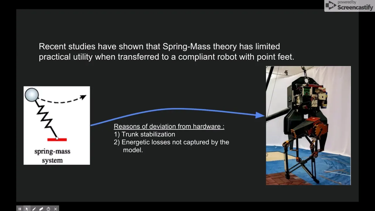
Gorkem Secer: TSLIP-based Deadbeat Running Control of Bipedal Robot ATRIAS
DynamicWalking-wv6qm
298 views•2018-06-22

4:10
Robotics
Self-Driving Cars Need Lessons On Human Drivers | Maddie About Science
skunkbear
26K views•2018-08-21

3:12
Robotics
Milrem Robotics’ THeMIS UGVs used in a live-fire manned-unmanned teaming exercise
MilremRobotics
99K views•2021-05-20
Trending

32:49
Engineering
we're almost finished the house (ep.125)
JennaPhipps
347K views•2026-07-22

21:29
Astronomy
We Finally Know Where Saturn’s Rings Came From
astrumspace
79K views•2026-07-22

12:13
Business
BIG BET: Cathie Wood goes ALL IN on Elon Musk
FoxBusiness
89K views•2026-07-22

13:55
History
MIC DROP: Smithsonian Director Called Out For Woke Propaganda
TheAmalaEkpunobi
37K views•2026-07-23