Severe weather forecasting involves analyzing atmospheric conditions including moisture levels (dew points in the 60s-70s), wind shear, and temperature gradients to predict storm development. During alert days, meteorologists monitor multiple parameters such as the Supercell Index (reaching 50 in this forecast), Significant Tornado Parameter, and rainfall rates (up to 2 inches per hour) to assess threats like tornadoes, straight-line winds, and flash flooding. The timing of severe weather events depends on storm motion along warm fronts, with storms potentially moving at 20-30 mph and affecting different areas at different times. Public safety during severe weather requires constant monitoring, maintaining charged devices for alerts, and understanding that isolated tornadoes, while less frequent, still pose significant risks.
Alert Day Special Report /17/26
Added:[music] >> Woo!
>> [music] [music] [music] [music] [music] [music] [music] >> Hey, hey, hey, hey.
Hey, hey, hey, hey.
>> [music] >> Good morning, good morning. About 1 minute away from the top of the hour.
Happy Wednesday, everybody. Welcome to a special update here with Storm Talk. As we enter our alert day mode for later on into the overnight hours, especially.
I'm meteorologist Brian Good. Welcome to the block here today. Nice to see you, a lot of you familiar faces back on.
Again, you can chat on our social media side, whether it is YouTube, X, Facebook, and Twitch. If you want to chime in the conversation or certainly ask any questions.
Otherwise, you can just enjoy the stream if you're watching from the app itself. You just won't see the comments. I'll try to bring up all the questions though that are asked so that you are included the best you can be.
What we're going to do is we're going to break down obviously the setup as we get into later on this afternoon into the overnight and to Thursday. I'm not going to touch base on any of the longer term stuff including the weekend. We'll come back around to that after this is over with. Fair enough.
And a lot of your questions, I'm sure, will come about as I'm going through all the maps. All I'll ask is just hang tight. Hopefully, as I evolve through the next couple of minutes here, I'm going to answer a lot of those questions.
And timing is a big one.
Everyone wants to know, what about my area at a certain time? Will there be a tornado threat? Will I get hail versus straight-line wind? I get it, there's a lot of questions on that type of aspect.
I'm going to answer that as best I can in the following charts and maps to come. So, give me a chance to get through that and then at that point, if I still didn't make any sense, then by all means, let me know. Fair enough? All right, let's dive into it.
As always, I like to start with the current setup and then we just dive into the uh the nitty-gritty the more we we evolve along here. All right, looking at the outside setup right now in Bartstown, actually really nice, nice comfortable morning. Certainly has been warmer uh to start the day off. We've been in the 60s for overnight lows versus the 50s, which were that was nice. But now we're getting back into that a little bit more of a a humid environment as the strong piece of wind energy is diving out into the Midwest.
It has arrived into the lower 48. So, it is now moving in and as each hour goes by today, you will notice a bit of a change in the atmosphere in two different areas. Actually three. Uh sky condition will change a bit today. Some high-level clouds are going to be rolling in for especially Indiana. We're going to see the humidity start to slowly ramp up as in the later of this afternoon. It will be a bit delayed. And then the wind, perhaps the most noticeable thing, will also begin to rise for the afternoon. Already see the dew points are back into those 60s after a break. We even had dew points in the 40s to start the week off. So, we can tell the moisture has returned and we're expecting dew points to get into the 70s for the overnight hours.
In fact, our potential rainfall rate on some of these downpours tonight that'll be moving in, uh will be approaching about uh 2 in per hour per hour will be the rate. So, as they slow down, that will be one of our bigger issues we'll have to watch. For a while, they'll be moving fast enough that to get to that true 2 in mark is pretty unlikely. But as they slow down into the overnight, well then that risk starts to go up and that will be in the middle of the night.
So, we'll cover that aspect as well. But that's one factor we'll be watching will be how much moisture is in the air.
Right now, it is quiet. We do have a little bit of uh clouds are kind of scooting by as the shear is starting to slowly ramp up to our west. So, we're seeing the reaction to that in the atmosphere. That'll create more of a hazy looking sky. Still enough heating. These are thin enough and high enough off the ground that you'll still get a modest amount of heating out of this. We'll get into the 80s for sure.
You see the little clip of a tornado watch.
That's not too far away. That's back here in Illinois. This is the warm front that is situated It's the same front that came through last night that washed out. It's starting to curl back up and heads slowly to the north and east today from central Indiana into northeast Indiana into Ohio as we get into the evening hours. Thunderstorms love warm fronts and they are using that as a train track this morning to evolve to the south and to the east. And in several cases, they are becoming severe.
But, this is just round one for this area. This is not the main This is not the main show. This is the appetizer for what will be developing later. You can see the canopy blowing off of the tops of the thunderstorms, the uh the anvil flow coming in. Uh pretty wild. I mean, that tells you how much uh wind energy is aloft. It is pulling the clouds way ahead. There's quite the tailpipe here uh with shear developing in the Midwest.
Now, some of that high-level cloud cover is going to track roughly, I would say, southern Indiana and up through Cincinnati. It will continue to progress and expand outward as it does. So, that's the reason why some of you may get a little bit more of that hazier sky later today. Now, this may taper down some of the instability into Ohio and eastern Indiana for a while. Um not only to mention you're going to get some rain, too, as these storms move on by. Uh we'll monitor this. Uh there is a low-end potential that for those you in Jennings County, uh Sorry, let me redraw that. Jennings County through about uh Carroll, you may get clipped by some of the wind potentially of outflows from this as it dives south and east. Your atmosphere will not be as prime on moisture though for these storms to survive, but you could still get some wind out of this as it blows on by. We are going to be monitoring that. So, again, I'm not going to rule out and that would be roughly about I would say uh 2:00 3:00. Actually, we'll give a window of 2:00 to 4:00 p.m. today that our northeast counties could get grazed by this complex of storms. It really just depends on how it behaves the next several hours. So, we'll be watching that. Once that progresses off to the east, then the atmosphere reloads again for the main show. Now, what is interesting about this is that the way this is timing out um parts of Indiana that are already in the outlook for a moderate risk enhanced may have a saving grace here.
Uh thanks to the morning showers and storms because this blob of rain and clouds that is going to be scooting across Ohio this morning, while that's is still going to be an environment where the shear is going to be tremendous and you can still recover from that. It's still early enough in the day. We have enough daylight you can recover.
But not a ton.
Uh the question now is going to be could some of these be what we call a little more elevated off the ground, the bases?
That would reduce at least some of the severe threat in areas that are a little bit more highlighted in a higher threat for now.
We'll see if that happens. I know it's out of our area, but the reason why I mentioned that is that will then cause us to focus on areas south and west of where those thunderstorms are on the warm front. And that will put us into a zone of Illinois into west central Indiana roughly in this area. So, there could be some redrawing. It wouldn't surprise me.
They did adjust the enhanced into our northern counties. They did move the slight down into Louisville.
So, there's been a slight shift. Don't be surprised if there's just a little bit more of a south uh jog here on some of these parameters.
It really just depends on how quickly this moves along the train track this morning on the warm front.
Uh this is what we call an nowcasting.
We take it hour by hour. That's one of the features I'm noticing that is uh developing. That's a level four on the severe just northwest of us.
But we have a level three now within wave country. I'll show you a closer view on that in just a second. Let's break it down as we see it can do that.
The uh tornado potential first.
Uh that is certainly elevated right where your best shear's going to be with the heating of the day. I still think Illinois is in a really rough spot here and west central Indiana. But we need to watch how these cells evolve. Well, there's still some potential for a tornadoes uh because there's going to be quite a bit of shear, plenty of shear.
For these storms to still rotate on. As we head into the overnight, they slow down enough that you start to lose some of that uh potential for tornadoes. You get a little bit of what we call an inversion. I'll show you some of that in a second uh at the ground level.
Straight-line winds become a little bit more of the dominant issue than tornadoes. It doesn't completely fade away. It's kind of a elevated risk on the tornado side, straight-line wind, and they kind of just slowly switch spots.
And unfortunately, our area, especially Indiana, will be where that that flip begins to happen. No doubt, if you are in southern Indiana though, you need to be very much aware of what's happening tonight and stay on it uh on an hourly setup because uh you guys are certainly more at risk and even up 71 uh for a potential for some damaging weather tonight. So, make sure you're paying careful attention to the changes cuz there will be several.
Uh around Louisville point south, we're not out of the woods, but um our focus right now is mainly Indiana and up 71.
All right, there's your tornado potential. 2% does go down uh to roughly Trimble County, Scott County, uh Indiana.
But I technically I think you can really draw that to I-64, and they may end up doing that. Still low end. But it's on the map. And that gets your attention.
Um let's break it down to straight-line wind potential. I think that's one of the bigger issues that will eventually evolve out of these cells. I mean, yes, tornadoes are going to get the uh the attention. They always seem to in these cases, but straight-line winds um are a problem, too, because they can take out down trees and power lines in a much more of a real estate of a county as they pass through. And if you lose power in the middle of the night, uh usually it's because of these kind of issues.
So, that will dive south and east.
Again, I think this will likely get nudged a little bit more south than what you see, and I think even the uh 30% will get nudged a little bit more into southern Indiana, too. That's my gut feeling. But, it's really just being picky at this point. I think overall threat is the same here. Indiana first, the rest of us will be a bit uh a bit later. Okay. Hail threat is only when these are supercells. Otherwise, once you get into a line of storms, your trail threat begins to peter out fairly quick. Uh so, it's mainly going to be an Illinois issue, but boy, they could be big.
Uh 2 and 1/2 to 3 in size and diameter on the hailstones. So, that could really um be quite the event, too, uh later on tonight. Uh this is going to be a bit much more delayed. A lot of these storms are going to be after 5:00 6:00 p.m. today before they really fire up in Illinois and Indiana. So, everything's really late. And really, the main show will not be really on radar and firing up for another 12 hours. So, we got a long way to go still, but right now the main focus is just that complex there into Indiana on the warm front. All right, so let me get into a closer view again. So, this is the general outlook, but within our counties, you can see the enhanced now stretches into Lawrence County to uh Jennings.
Uh the slight roughly I-64 corridor, and then tapers out from here. Although, this is mainly going to be your tomorrow threat, uh the way it's looking now for um our southern counties. At that point, we are already being daybreak on on on Thursday. Okay. So, what I'm going to do, I'm going to show you several pieces of data, several different ways to look at this. Some of this is going to be a very scientific, nerdy moment here, but some of you love seeing that type of data, and we don't have a chance to show this on TV cuz we don't have enough time.
But, I have some time here today, so we're going to show some of that, just to give you an idea of some of the parameters and whether or not they're significant or not. The first thing I'm going to show you is a pretty basic outlook here, and that is the futurecast itself. And, I'm going to walk you through this hour by hour all the way into tomorrow afternoon. So, pay attention to where you're at on the map, and pay attention to the clock at the top left.
The gray area, white area, those are the clouds.
The red is the fuel. When it's a dark red, it's actually low-end amounts of fuel. When it gets into that bright gold color, it's high amounts of fuel. So, several different things to watch here, and there's no precipitation yet cuz it's not here yet. So, I'm going to advance this. Let's move on. Let's get 2:00 3:00 in the afternoon. This is when the complex is going to be rolling in on the warm I think the her model here is too slow.
I think it's going to be just a tad faster getting into the Indianapolis area, and then at that point, we'll see how close it can graze from Jennings into around Carrollton. It It takes it pretty quickly to the right cuz the warm front is moving at the same time. As they're moving southeast, the warm front is moving northeast, hence the shear. But, it's pulling it north as it moves along the track. The question is, does it get too far down the track before the front has a chance to get too far away from us? And, that's a good question. We can only answer that by watching the radar trends on an hourly setup. And, basically, what I've seen so far, I think it will have a little bit more of a southeast progression than what the model shows here, so that's why again I want to caution those you northeast this afternoon just to stay careful uh uh attention Pay close attention to the hourly setup. Okay, so when then we get into the evening. All right, the fuel begins to build up as well as we head into our sunset, here come the storms that'll be uh likely still supercells around Indianapolis all the way into southern areas of Illinois. Uh, it'll already be ongoing by the 11:00 news, and once we get into the midnight hour, they're moving in. Now, as I mentioned, some of these could be elevated based on what happens today. So, my attention is quickly focusing on what will develop here into west central Indiana near the Wabash.
And tracking cuz the wind shear again is quite strong, especially the push of west to east. So, these will be tracking rapidly more east individual cells will be, but the line is moving south. So, there's two different motions happening.
So, when you look at the radar tonight, you kind of have to keep in mind that if you have a lot of red just west of you, it's likely building your way, but also keep in mind the front is slowly pushing southbound. So, kind of a southeast jog is what you need to keep an eye on in relation to where you're at on the radar when you look at the app tonight. At 1:00 a.m., it's approaching our our northwest side.
We get into 2:00 a.m.
Most of this is going to be bowing segments, but there will still be some cells individual supercells embedded in this line. So, that's where you're going to get still some rotation uh that can develop along it, and that's where the tornado threat will continue to be an issue um especially early on into the overnight.
All right, let's advance this to get into uh 4:00 in the morning.
The hurricane consistent on that being around 4:00.
Think it's probably a little too slow, maybe an not that far, maybe another hour uh or so a little faster than that, but it's close. It's close. We'll give you more timing ranges here in a second.
But, you can just look at the orientation of it. At this point around 2:00 to 3:00 in the morning, this is going to be lined up along I-71. It's going to be bearing down on the city of Louisville in the metro in general and all the way back into Evansville. That will likely be the configuration that we'll have during the overnight. So, if you're in Indiana, as you can tell, you're up first. If you're south of Louisville, you may see some lightning in the distance, but this line starts to hit the brakes around 4:00 to 5:00 a.m.
and slows down.
So, the question at that point is how long is it going to take to get to Bardstown and Elizabethtown? Well, it may take until sunrise or daybreak on Thursday to really get to you. Could still be strong.
Just you're in a severe risk. You're actually were removed yesterday. Now, you're back in it uh because of the idea that some of these cells may have a little bit of some bowing segments, which can advance the line a little further out um than first expected. And then it stalls.
Here we are 1:00 in the afternoon on Thursday. It's still in Bardstown, at least in the region of the parkways.
And now we're going to switch into not only a severe weather setup, but now we got to pay attention to those rainfall rates of 2 in an hour.
Cuz now we're going to have a problem here if it stalls in the same areas and you get multiple rounds of storms, so they just don't really move. They just keep repeating over your backyard, now you're going to run into a flash flooding setup. At least Indiana, it moves fast enough that that looks to be a somewhat limited. I mean, you're still going to have brief ponding of water for sure, hydroplaning concerns cuz the rate's going to be so intense. I mean, this is true tropical downpours. You're not going to see anything out of this.
It's going to be raining so hard. But tomorrow, it'll be raining hard and not moving much.
Louisville could get lucky. We could see that band set up just south of us. Now, we're not completely out of the woods.
There is a secondary boundary in Indianapolis that may move in later in the day to give us more rain. And you see hints of that firing up as we get into sunset. I don't see that one being severe.
Um I think that one may have some gusty winds, but I don't see that being the main show just because this line to the south and we will have a tropical system, too, in the deep south. A lot of that is going to start to block the moisture as it crosses as that spin of what may or may not be after, who knows, but it's the tropical cyclone uh potentially that's forming there and to Louisiana and eventually heading into um uh Mississippi and Tennessee. Once it gets just east of 65, it does tend to block a little more of what's happening here on the flow uh of moisture into the um into the Ohio Valley. But still, gusty winds, you bet. That's the reason why the alert day is going to continue all the way into Thursday night.
And then at that point, we'll be able to say goodbye to that system and have a a bit of a break. All right, this is looking at the entire setup you just saw, but in numerical form, and this is where we get into some of the nerdy stuff, but it is interesting to look at and I hope you can read it all right. Uh a couple things to point out.
Your temperature's right here in this first column, there's your dew point in green.
There There are the P Watts, we call the rainfall rate.
You see it goes up close to 2 in and into the overnight.
There your wind gusts, we'll come back around to that, but this is a mix of general wind and thunderstorm wind. So yeah, it's up there.
Your uh supercell index, which uh gets to about 50, I believe. So it's elevated. I think we do max out a little bit about 23 for supercell, so about halfway of the max potential, you can see on supercell. So it's elevated, it's not I wouldn't say overly high, but it is certainly notable.
And your significant tornado parameter, uh it's not above a five. Once you get it to a five, I really get worried. Uh it's below five, but it's uh certainly above a one. And anytime you're above that one, you uh run into that chance for an isolated tornado that um could certainly be um isolated cases that one or two could be on the strong side, especially in Indiana. So that index is noteworthy. And it has a jump compared to previous runs this morning.
This is the highest I've seen it so far.
Is that a trend or is this particular model update a blip? We'll find out. The next run's coming in right now, so we'll find out what happens there. Here is your tornado potential on the map version. It's the same thing that you just saw, the threes and the fours, but it's looking at it on a map side. So, this afternoon we're not quite in the environment, obviously. We get into tonight, again, our concern's going to be when these cells move in to Lawrence County, Jackson, uh the boys, Orange, uh Washington County.
That's where I'll be watching to see how does this evolve around 11:00 news to midnight because you have the greatest potential for a problem for an isolated tornado um than anybody else. Well, otherwise, you'll have a burst of straight-line winds, for sure, as this passes through.
Here we are at 12:30, still elevated.
Then we get into Louisville, uh 2:00 in the morning. It really ramps up around Crawford County, Southern Indiana.
It's up there. I mean, it's on the scale, it's about here.
Just above elevated, not quite into high, but it is um a little abnormal to see this kind of an index. Now, it will be battling a inversion, which, not to get overly complex, but this naturally happens at night. So, there will be some of the bases that hopefully will be high enough off the ground that we we don't have this become the reality. This is potential that the atmosphere can take advantage of. So, there's two different things. There is the reality of what we could get and the potential. This is potential. I think the reality may be a little tamer just because of the inversion overnight. Uh but this, no doubt, is not something you see very often for an overnight window.
It typically fades out. So, the fact that it, if anything, ramps up is significant. And I think that's the reason why we need to pay attention to Indiana, especially, uh between that 11:00 and midnight to our 2:00 a.m.
window. Uh we get into uh Kentucky at this point at 4:00 a.m. We start to lose the parameter. It doesn't go away completely, but it does lessen quite a bit.
All right, the next issue is going to be just general winds. We do have um winds going to be ramping up. This is just typical wind with even the sun out kind of thing. Your gradient wind.
Yeah, it's getting up there. I mean uh 40 is the threshold. At least frequent gusts of 40 is when we start talking about a wind advisory. If we see this, at least a moderate area here, it would be the first time ever in June. We would have a wind advisory for part of the area. We'll see if that happens or not, but they do elevate. Now, once we get past sunset, there is a slight decrease that will happen around sunset, but then we switch gears to thunderstorm winds.
These are mainly thunderstorm winds we're looking at into the overnight, and you see Salem at 53 mph.
Excuse me. [clears throat] Frankfort at 50.
Um we're hoping again the inversion will cut down on some of this, but even if we were to tame this down and adjust it, it's still going to be quite strong and can still cause some problems uh for some uh wind damage and tree damage as it moves in.
Uh and then that continues to weaken into the overnight, but it does remain gusty tomorrow. Again, those secondary lines that move in could still have some gusts with them as that It's a one-two punch that will likely form. I'm seeing that on most of the modeling now that's coming in. We've got the midday band of storms, and then we get the late afternoon that approaches. But again, the second one should be weaker than the one that's going to be in southern Kentucky. All right, wind advisory is out in Evansville.
We'll be interested to see if they try to connect this a little more like this and fill in the county just or along the river and north. They could do that. Whether service uh it's their call. I'm sure they're evaluating the midday data right now. We'll let you know. Obviously, if you have the Wave Weather app, you're going to know at the same time we are cuz it'll be automatically hitting your app.
Storm timing. Best way I can see to explain this is uh general time frame and a window. And again, you get to the 11:00 news, they'll be approaching. We get to midnight to 3:00, it's all by Indiana.
We get closer to 3:00, it's going to be all about 71.
Because there's going to be a bit of an angle to the storms here, so it'll impact Jasper perhaps before Carrollton will because of the angle they will have.
Once we get into the overnight hours, 3:00 to 6:00 a.m., that's when it's going to be an I-64 Louisville issue.
Louisville probably load closer to that 3:00 to 4:00.
And then 6:00 a.m.
around Bardstown, and then you'll hold on to that around Bardstown south for mainly the Thursday time period. It'll remain steady, but the parameters on severe still up there. I mean, you got a slight risk for tomorrow.
And a a marginal here locally and Louisville, so you could still get some severe weather, but obviously it's not going to be as violent of an atmosphere as what Illinois has for this evening.
Uh it'll be a team-down version, but even the team-down version could still provide for some damaging winds. So, that's something that we will be watching. Okay, that's it.
I'm going to get the whole timing up, and get the summary of questions.
I want to keep it hopefully as simple as I possibly could today cuz I didn't want to get too in the weeds in this cuz it gets complex.
But I just wanted you to get the I did the basics down, when and what type, and more importantly, what you need to do to prepare. And it's very easy here, very very easy.
Keep checking back in on the forecast, and two, have a way to get notified for the middle of the night. Keep your phone. When you go to bed, most of us charge our phone anyway when we go to bed, right? Make sure to keep it charged up as you go to sleep.
That way if there's an alert that hits it, it'll automatically um will let you know.
All right, some of your questions here.
Um Is the wind threat or tornado threat higher in Louisville metro tonight? The wind threat is higher than the tornado threat.
Um both are elevated, but I would say if I had to put one over the other, it would be the the bowing segment straight-line wind.
Hey there, is it J.C.? Sorry, or Jinxie?
I can't can't see the name very well. Sorry, I apologize. Could the enhanced be possible for Louisville?
I don't think enhanced, no, for Louisville, but I think more of Indiana may get included, but I think slight for Louisville is fair for what I've seen so far.
I would hold that. I wouldn't pull back on it, but it really does depend on how the next few hours go, obviously, into this afternoon.
But the enhanced the US 50 corridor may it may bounce around a bit there today. It I'll be interested to see how that plays out. Is anyone in the enhanced or moderate? Yes, enhanced for far northern counties from Lawrence into Jennings.
No moderate in our area, though.
Hey Chris B.
Elissa Swartz, they're general. I didn't get a chance to load it in, but and mainly because it's got some hints, but nothing that's outlandish.
Um, because you start to lose this forward motion of the front. So, again, there's a trade-off that happens. It's nothing like what Illinois and Indiana have.
So, it's important to note that. So, while we talk about tornado potential, I never want to ever just say, oh, just an isolated tornado, not a big deal.
It is a big deal that isolated tornado is you and hits your area, right? So, I don't like to downplay it, but in terms of the threat, it is obviously lower than Illinois and Indiana, especially in central Indiana will be. Um, but it's not zero. So, you still got to prepare. I mean, I I don't think it's one of the situations you should ever take lightly, especially for the overnight, because we are limited in severe weather setups, we're limited to a lot of it just being radar data.
Cuz we can't see anything.
So, that makes it tough. A lot of it's going to be radar indicated.
Sometimes we don't know if something's doing damage until the damage reports come in. Damage reports can sometimes be delayed 30 minutes to an hour when we're doing our coverage.
And we look for that constantly.
But if it hits an area where they've lost power, no one can communicate that there is damage. It takes a while to get the calls in to dispatch from the local um police forces and and uh emergency managers. And that delay is is is important because the faster we know, the more we can let you guys know in advance of it, right? But if we get those reports nearly an hour later, well, it's a little too late cuz now we know it's doing damage, but it's already hitting the next community and set of communities. So, those reports are crucial tonight for emergency managers that will be getting, but radar data is going to be our number one tool. But it is a challenge. So, as always, we appreciate your patience on that because we just have to hunt for it. And if you guys get damage, obviously, we're going to have a link that will be uh providing for you guys later on today on social media that you can uh submit to and that way we can get them for two to the weather service so they can also adjust warnings if need be. So, you guys play a big role as well. We also want you to be safe and hopefully have a peaceful night tonight.
Hey Chris, is SPC using tomorrow's slide as a buffer from overnight?
Uh basically, yes. Uh you you still got some shear on the front and you got a tropical sub. You tend to get more of the wet um microbursts we call those where you're so humid, you can end up with um bursts of wind versus tornadoes. Uh but you can never let your guard down when you get the tropical influence. You always have to monitor that.
The flash flooding, I think it's going to be a one of the bigger concerns tomorrow just cuz it doesn't move.
Doesn't move.
Um Someone's asking about their locations.
Uh again, I got the map up, so hopefully you know where you are on the map.
And that's the timing.
Uh if there's a watch along the river, most likely severe thunderstorm, mhm that's a good question. Uh that's the Storm Prediction Center call. Honestly, I think they probably would do a tornado watch uh for Indiana Indiana or counties in Indiana, but it just uh depends where they place the one for this evening. Uh I'm sure there will be one for Illinois and Indiana, but it depends on how far south it goes. If it goes they may draw it down to like Paoli and Salem. But then when the storms get to that point, then could the next one on the river itself be a severe thunderstorm watch it would include central Kentucky. Well, that's fair, maybe.
So it it yeah, it's you know, schematics don't worry about it, but either way, you know what the the game plan is from watching right now, right?
So that's what I want you to focus on not so much with the type of outlooks or the type of watches.
Don't uh worry about that. Just worry that there is a um a setup for severe weather and you need to be weather aware.
Very warm and humid this evening. Uh it will be uh more so later on tonight, especially if we get past sunset the humidity levels really ramp up more. The moisture plume is rapid right in advance of it just in advance of the front.
You're really going to notice it. And tomorrow is going to be just a really sticky day tomorrow. Very tropical feeling tomorrow.
Air you can wear kind of day. We don't get a lot of sun tomorrow, but um it will be humid.
Hey ZK.
Um Okay, y'all are talking about timing.
Thank you all for helping each other out.
Cuz the comments are flying by so fast, so sometimes I miss your questions, but we have a lot of uh deputy meteorologists that help us out um in knowing the game plan, so I appreciate that.
Hey Jacob, I saw where LaGrange was getting up to 50 to 60 wind gusts tonight. Does that encourage severe tornado risk? Uh that's more of a sign of likely just straight-line winds, but that model it's two different things that happen. You got general wind that is happening because this is such a strongly sheared environment. So we're already just take the storms off the table. We're already going to be on average of 30 to 40.
Just by itself. Typically, you add when you have a forward motion, you add that speed the storms are moving. That can add about 20 to your potential gusts and at that point that's your number you can get on wind damage. So, if we are averaging 30 to 50 mph winds tonight and the storms slow down to 20 mph on dropping out of Indiana and eventually they will slow, then that'll put us at roughly around 60 mph for potential wind gusts. That's fair. But for Indiana, especially around Bedford and Seymour, they still may moving fast enough that as they're dropping southeast, they could add more than that and get closer to 70 mph even a touch higher. So, there's no doubt your straight-line wind potential is going to be higher just because of the forward motion. I hope that makes sense.
It's all about dealing with math here on this, but um as the storms slow down, uh just keep in mind the storm motion. When we talk about the storms you see on the app or you hear it on the weather radio, listen to the storm motion and whatever the wind is out your window, add roughly about 20 to that and that'll be about the potential that it could do when it moves in. And that's a very loose uh relationship, but it does work pretty well to be honest.
To try to help you out in gauging anyway.
Hey Ashley.
Uh what's your question? My mom and sister leave for uh leave for work at 4:30 in the morning.
Um west and northwest of E-town. Uh it'll likely Yes, I think it will be storming at least approaching at 4:30 uh as we get into Hardin County, but at that point it'll be transition to more of heavy rain and flash flooding. Just tell them be careful traveling uh as uh it's going to be hard to see cuz the rainfall rate is going to be pretty heavy.
Uh they may get lucky and squeeze just ahead of the line. It's going to be close.
It's going to be real close. It may be in like in Radcliff and not quite in E-town at 4:30. It'd be that kind of a close call on placement anyway. But you'll get still the tamer version of what Indiana will be. And I'll make sure I'm stressing that. There's a difference between Indiana and I-71 in there, the I-71 corridor. There's a difference in that zone versus south of 64. There's a pretty obvious switch that happens here.
Louisville's of course right on the edge.
Like a rain-snow line.
Uh what's your preference in these events? Tylenol, Advil, leave?
All of the above.
Um It's like you're driving a car at 16 and someone is driving in the other direction at 20, you were getting hit at 80. Uh yes. Well, it's it's you know, sometimes our storm tracker when it's out in the field, um it'll register a really high wind, but that's because it's factoring the wind gust and the forward motion of the vehicle. So sometimes you see some wild numbers on there. We try to point that out.
Not going to get any sleep tonight. I know, I know. It's going to be one of those long nights, but hey, you know what? We're going to be here.
We're going to be watching it. It's not going to sneak by and we're just not going to be paying attention to it.
That's not going to happen. In fact, there's probably not a meteorologist in the region that is going to be doing that. So uh this is going to have high aware- awareness to it. It has been for days.
So that's in your favor. High awareness is absolutely step number one to preventing uh injury and hopefully no fatalities in these kind of setups because as long as everyone's aware, you're more protected, you're more uh prepared to get into a safe spot. It's when you are caught off guard, that's when we run into problems with uh casualties that go up. So the more awareness there is, we really see there's no doubt. That's why we talk about it so much. That's why we have alert days. It's proven and it makes sense. It's a pretty matter-of-fact thing, right? That the more you're aware, the more you can better prepare.
So these get a lot of attention for a reason. It's not to hype and scare anybody. It's just to make sure that we reach everybody. There Believe it or not, there are still people that have no idea there's going to storm tonight.
I've heard from them. They still don't know. Um so our goal, we got to reach everybody.
And for some of you, I know that means this is the 20th time you've heard about it. But there's still somebody that hasn't, and I hope you can understand and be sympathetic of why we still got to reach that one person nearby you that probably doesn't know.
Cuz we don't know who they are or where they're at or at. We just got to be there for them and hope they catch us.
So when you share these videos on your social media page, that helps us too cuz that maybe that'll reach somebody that is not aware.
So you guys play a big role. We uh we appreciate that.
All right, guys. I got to end it now because it's I'm getting close to getting ready for midday.
So I got to get ready for the show uh for midday. And now I'm going to have the latest uh maps on that. I think we have another SPC update that'll be coming out at 12:30. If there is a significant change on the data that comes in from midday, I will do another update into the early afternoon. If it's relatively the same idea of what I've just presented, then we'll just let that go for our newscast and we'll keep you updated. Obviously, Kevin and Ryan will be on tonight uh to walk you through it as well. But again, if there's anything significant, I'll be back. Otherwise, um I've laid out the game plan and I think it's where we're going to hold on to it uh for now. All right. Thank you all for watching. Stay safe and uh enjoy the afternoon cuz really, it's not going to be a bad setup this afternoon. Just all about waiting for uh waiting for tonight, right? All right, take care everyone. I will see you in about 30 minutes [music] on the tube.
>> [music] [music] [music] [music] >> Woo!
Related Videos

Half This Waterfall Disappears Forever (The famous "Devil's Kettle")
MysticMatrix_real
828 views•2026-06-18

Extreme Storms Hit Poland: Wrocław Floods, Leszno Damage, Wielkopolska Chaos
Worlds_DisasterTV
112 views•2026-06-22

TVK அரசின் உடனடி நடவடிக்கை ! Arappor Iyakkam Jayaraman | Pallikaranai Ramsar Issue
ColorKannadiVoice
18K views•2026-06-18

You Can Make Lemonade From This Tree?! - Staghorn Sumac
TN-Nursery
203 views•2026-06-18

Tonight's Forecast: Staying cool heading into the weekend
FOX17WXMI
172 views•2026-06-19

Tornado Watch for Central Indiana | 7:30 P.M. UPDATE + RADAR
WTHR13News
7K views•2026-06-18

i found an oasis in the desert!
Westnilekills
870 views•2026-06-17
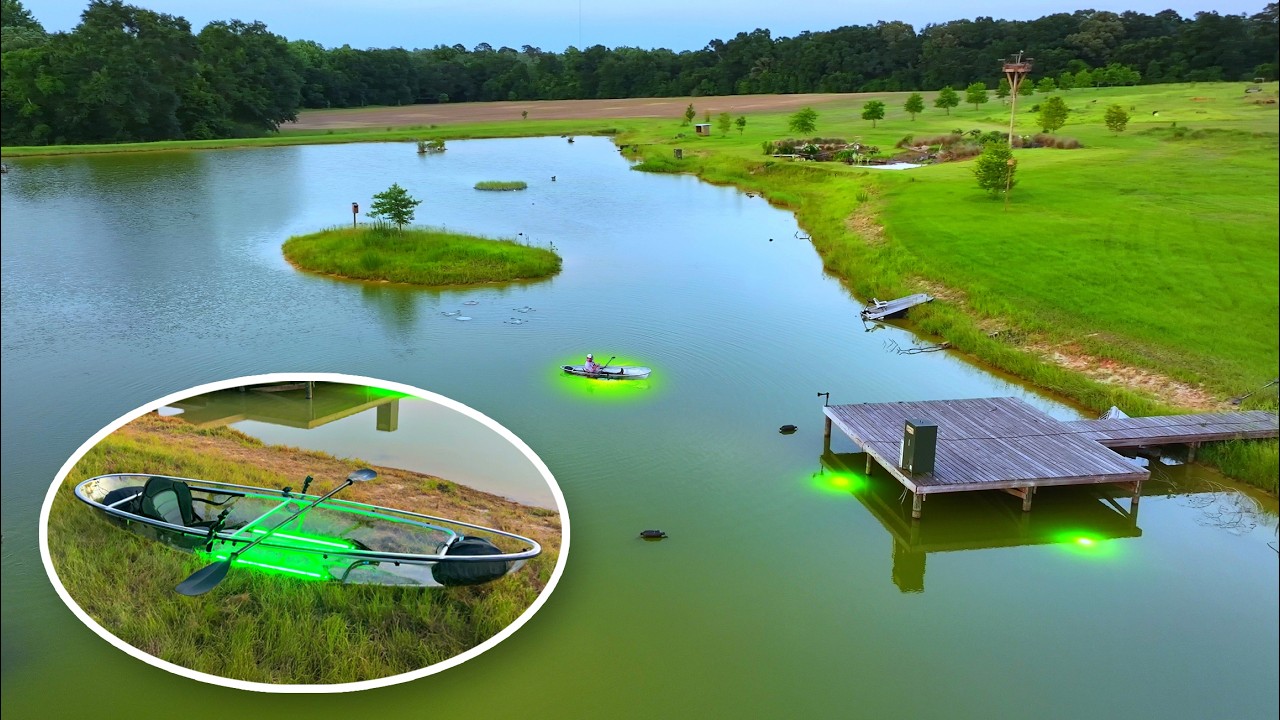
Exploring the 5 Acre Pond in a Glass Bottom Kayak! (Glowing LED Lights)
BamaBass
38K views•2026-06-22
Trending

Nobel Scientist Creates Device to Harvest Water From Desert Air
DrBenMiles
2200K views•2026-06-16

He’s the RICHEST MAN in AFRICA
Schoolofhardknocksshortz
1032K views•2026-06-19
The First Photos On Venus’ Surface
CleoAbram
5145K views•2026-06-18

Didn't Think It Could Get More Pathetic
penguinz0
377K views•2026-06-21