A solid integration of computer vision and sensor fusion that provides a scalable framework for localized airspace monitoring. However, its practical effectiveness will hinge on overcoming the inherent range limitations of stereo imaging in dynamic environments.
Install our extension to search inside any video instantly.
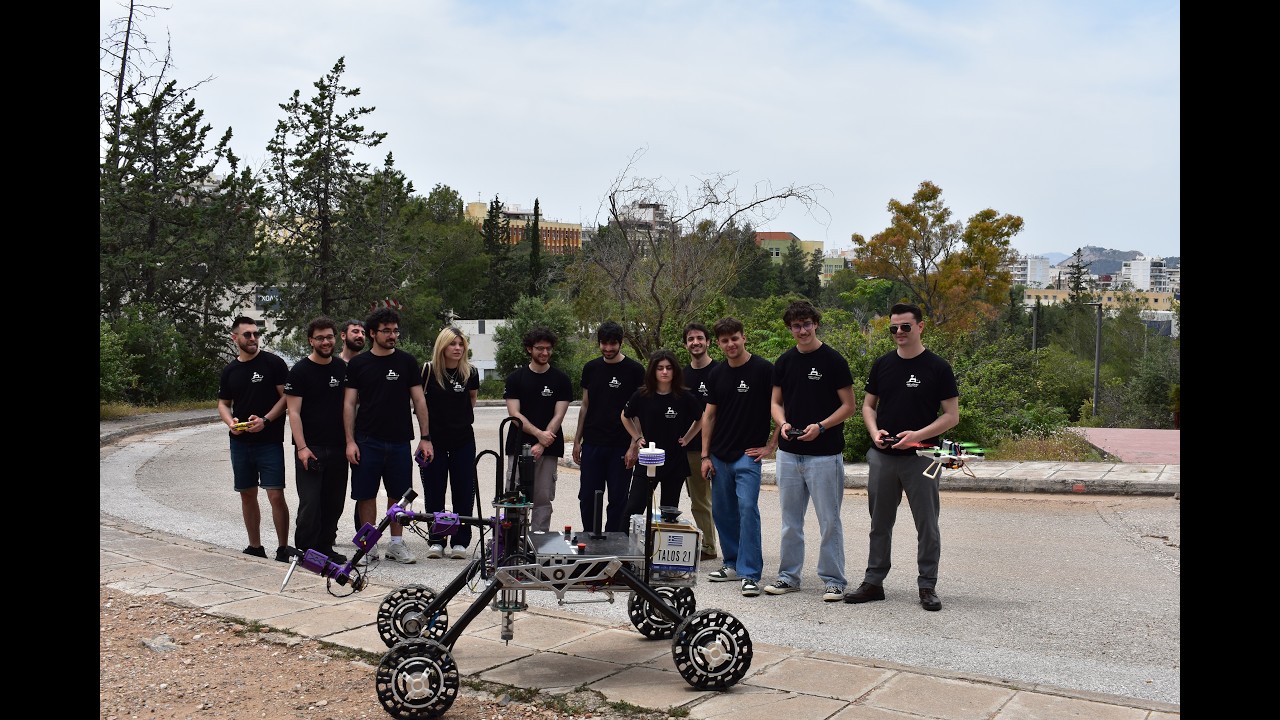
26041 – Distributed Counter Uncrewed Aircraft SystemAdded:
Every month now, the Federal Aviation Administration receives about 25 reports, 25 [music] a month, of unmanned drones flying in restricted airspace or flying too close to commercial or [music] private aircraft.
>> March 9th, a swarm of drones repeatedly hovered around Barksdale [music] Air Force Base in Northwest Louisiana. A spokesperson for the base tells PBS NewsHour that it was unauthorized and criminal activity. It's [music] now being investigated by both federal and local law enforcement.
>> the US consulate in Dubai is reportedly been hit by a suspected Iranian [music] drone and is currently on fire.
So, over the past decade, uncrewed aircraft systems have rapidly advanced, becoming more affordable, widely available, and increasingly utilized both commercially and by the military as low-cost, scalable tools.
As a result, we're seeing them appear in unauthorized or sensitive areas such as schools and hospitals, where they can pose uh significant risks to public safety. Our project aims to address this challenge by detecting [music] and localizing and logging small UASs in the field while remaining low-cost [music] and a lightweight solution, ultimately helping to create a safer airspace.
What were the primary goals for this project?
So, our primary goal for this project was to develop two deployable modules for use in the field. Each module is designed to meet key system requirements, detecting a UAS in the minimum range of 100 m, achieving localization accuracy within 100 m, and communicating wirelessly. Additionally, the system is built to operate continuously for 24 hours on a portable power supply, maintain an IP64 weatherproof rating, and weigh under 30 lb per module.
What is the overall broad design process you followed to get here?
Well, our overall design process followed four main phases. Number one, system architecture defined [music] by the big picture, how the sensors and processors and links work together to detect the drones. Number two, the mechanical and hardware design, designing weather proof enclosures and custom PCB power modules. Uh and number three, our software and AI trained [music] on a real-time YOLO detection model, built sensor [music] fusion and inter-module communication. And number four, our testing and validation. Scaled from bench test to field trials verifying every requirement with real data. So, the drone flies into airspace, what exactly happens from the moment it enters the camera's view?
The moment the drone enters the camera's field of view, the YOLO model on the Raspberry Pi identifies it and calculates its position in the frame. We then fuse that visual data with our GPS and IMU sensors. Within milliseconds, this information is time stamped, logged locally, [music] and broadcasted over RF link to the other module so the entire system can begin its triangulation process.
So, why do we have multiple modules? We use multiple modules to take advantage of stereo imaging technology.
One camera has the ability to detect the presence of a drone, but it has no perception of depth by itself.
By using at least two modules spaced apart, we can create a stereo imaging system that captures the drone from two distinct lines of sight. Then we can share the data over the RF link to calculate the coordinates [music] where those lines intersect.
So, how do you the different sensors work together for triangulation?
To make triangulation work, each module needs to know where it is and where it's looking.
The GPS tells us where the module is standing on Earth, while the IMU acts like a digital compass and level to tell us the camera's orientation.
The camera then identifies the drone to give us a relative angle from its bearing. Uh by comparing all three, we can turn 2D images into a precise 3D vector. At this point, we can mathematically find the exact point where those paths cross in the sky.
So, can you talk about the enclosure?
How do we ensure it's weather proof and waterproof?
For the housing, we chose a polycarbonate enclosure because it's much more impact-resistant and it's more UV stable compared to other plastics. And to ensure it's waterproof, we designed the enclosure to an IP64 rating using rubber gaskets on the main lid and we also used them on the specialized cable glands for every uh entry point into the box.
So, how portable is the final module and what is the deployment process like?
The module is designed to be easily portable when it's fully compact. It's compact enough to be handled by one person >> [music] >> and weighing just over 20 lb, deployment is incredibly simple.
You uh you extend the tripod legs and raise the sensor head to clear over any obstacles and just flip on the power switch. And once the power switch is on, the system automatically initiates and you're ready to start monitoring.
Why use the Pi 5 as your main computer and what does the custom PCB do for us?
So, we chose Raspberry Pi 5 because it has the processing power needed to coordinate all the sensors while remaining small and energy efficient. To keep it running smoothly, we designed a custom PCB board that acts as the system's power hub. Um it takes the 12.8 V from our battery supply and steps it down to a stable 5 V while using filtering and protection circuits to ensure that the power is clean and safe for all connected electronics.
So, how does the module actually see the drone? So, the module sees a drone by running a nano-sized YellowV8 neural network, which is an AI model designed for high-speed object detection. So, it scans every frame of the live video feed, and it looks for the features of a drone that it's been trained on. And when it finds a match, it'll draw a bounding box around the target with a confidence score of how certain the model [music] is that it is a drone.
So, why do we use the Halo hat?
So, one of the most critical components within our design is the Halo hat. And without it, the Raspberry Pi's CPU would struggle to run the Yellow model at the camera's frame rate, and that would cause the video to lag and drop frames, and we would miss [music] detections.
So, the Halo chip offloads the Yellow's heavy mathematical workload from the Pi, which allows us to process many more frames per second, and it ensures that the detections are actually made in real time. So, once the model sees a drone, how does it share the information with the others?
The module communicates over a 2.4 GHz wireless network. The moment a drone is detected, the module packages that detection data into a small, fast data packet and broadcasts it to every other module in the area. This broadcasting method is ideal because it's low-latency, wireless, and doesn't require a complicated setup. Any module in range immediately receives the detection event.
So, how are we logging all the data so it can be used later?
Every single piece of data, from AI detections to GPS and IMU readings, is saved [music] locally onto a microSD card inside the Raspberry Pi. We store everything in structured JSON and CSV format, and ensure there's enough storage to log continuously over 24 hours, so no critical data is lost during long deployments.
So, in conclusion, we've been able to create a system that is able to localize between two modules the distance to a drone, and is able to run with a duty cycle of over 24 hours, and is easy to deploy, and is dynamically deployable anywhere in the field in a short period of time.
Is that it? We good? We good.
Let's do it. It's a wrap? It's a wrap.
Related Videos
Beyond Robotics | European Rover Challenge 2026
beyondrobotics
189 views•2026-06-01

Beatbot Sora70: JetPulse Technology and AI obstacle avoidance and navigation!
DroidModderX
26K views•2026-06-02

Tesla FSD 14.3.3 Hits Phoenix Streets - FIRST LOOK
anthonystesla
114 views•2026-05-29

Elon Musk Just Revealed Fremont Line for Optimus Gen 3 Mass Production
TheAINexusOfficial
180 views•2026-05-30

人機一体「零式人機 ver.2」 子ども企画【おもしろ発見!モビリティー】 #乗り物 #automobile #robot #shorts
KyodoNews
1K views•2026-05-28

China’s New Luna AI Robot Looks Shockingly Human...
NextGenHumanoids
850 views•2026-05-28

Reachy Mini: the $300 open source robot you can actually hack — Andres Marafioti, Hugging Face
aiDotEngineer
662 views•2026-05-29

柔軟指×AI画像処理食品の仕分け作業システム!#柔軟指 #ロボット #自動化 #製造業をもっと盛り上げたい
KiQ_Robotics_Corp.
113 views•2026-05-28


