Ground penetrating radar data from the Durupinar formation in eastern Turkey reveals unusual patterns including straight lines, right angles, symmetrical compartments, and consistent layers that do not match natural geological processes, combined with soil chemistry showing elevated organic material and iron compounds, and borehole cameras revealing structured cavities with fibrous material, suggesting the presence of a buried man-made structure rather than a natural formation.
Install our extension to search inside any video instantly.
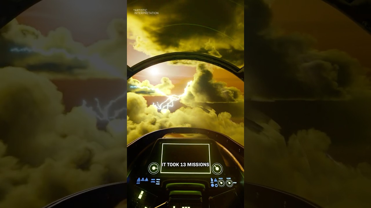
They Fed Ground Penetrating Radar Data Into Grok AI and What It Found Changes Everything
Added:In 1985, the long hunt for Noah's Arc takes a sudden turn when a 4,000-year-old clay tablet is discovered in the attic of a British Air Force veteran.
>> 80 ft below a volcanic hillside in eastern Turkey. Radar waves [music] passed through soil that had not been disturbed in thousands of years.
>> God floods the earth, sparing Noah, his family, and two of every animal on board his ark. Now, [music] an international team of researchers have found new evidence that a famous formation in Turkey [music] could be the site of the ancient vessel.
>> The data came back wrong. Not wrong like a malfunction. Wrong like something was buried there that had no business being buried there. When that data was fed into Grock AI, what came back stopped the team cold.
>> What in the world would a boat be doing way up there? Two sides, no middle ground. For as long as anyone has been asking whether Noah's ark was a real object, the debate has looked the same.
On one side, people who treat the biblical account as literal history and believe the ark landed somewhere in the mountains of eastern Turkey after the floodwaters receded. On the other side, people who treat the story as a moral narrative, a teaching tool never meant to describe a physical event that left physical evidence in a physical location. There was no middle ground for a long time. And the reason there was no middle ground was simple. There was no evidence.
>> And interestingly enough, researchers found that a massive flood may indeed have taken place. And it happened right near where Durupanar's [music] photograph was taken in Turkey.
Without something you could measure, scan, or date, the argument stayed exactly where it had always been. Two camps talking past each other with nothing new to add. That changed when the radar data came in from a site in eastern Turkey called Durupanar. [music] Because radar does not take sides, it does not believe or disbelieve. It sends signals into the ground and records what comes back. and what came back from Durupinar did not fit either camp's expectations cleanly. Recent discoveries in this region are forcing scientists to reconsider assumptions that have been treated as settled for decades.
>> Researchers in Turkey now claim [music] they found indisputable evidence that the story of Noah's ark was not a cautionary tale about the consequences of forsaking God, but a verifiable historical event. The ground is telling a story that the textbooks did not prepare anyone for.
>> The the worldwide tradition of a of a global flood stops being just a myth and starts being a memory.
>> What the radar found at Durupanar opened a door that no one was fully [music] ready to walk through. The shape on the hillside. The site sits on the volcanic slopes of Mount Tenderek [music] in eastern Turkey at an elevation of roughly 7,000 ft. If you look at it from the air, the first thing you notice is the shape. A long smooth oval slightly raised at one end, sunk into the hillside in a way that does not match the surrounding landscape. The outline runs for more than 500 ft. The edges are clean. The symmetry is visible even from a distance. Local people have been pointing at this formation for generations. The site carries the name Durupanar after the Turkish military cgrapher who documented it formally in 1959. But the people who lived in the surrounding villages did not need a cgrapher to tell them it was there.
Their parents and grandparents knew about it. Their tradition held that the shape in the hillside was the remains of a great ship that had come to rest there after a catastrophic flood long before anyone could remember. The dimensions of the formation match something specific.
The book of Genesis describes the ark as 300 cubits long and 50 cubits wide. A cubit is an ancient unit of measurement based on the length of a forearm, [music] roughly 18 in by the most commonly used standard. Run those numbers and the ark described in Genesis would be approximately [music] 450 ft long and 75 ft wide. The durupinar formation measured from its outer edges falls close to those proportions. Close enough that the match is not easy to explain away as coincidence and not so exact that it settles the question on its own. What the dimensions alone could not determine was what was underneath the surface. The shape was visible. The size was measurable. What the ground held beneath the soil was not something you could determine by looking at it from above.
That question waited for technology that did not exist in 1959 to come and answer it. What the scans revealed. Dr. Andrew Jones did not go to Durupanar expecting to find anything remarkable. His team brought ground penetrating radar equipment to the site with a straightforward goal. Run the scans, confirm that the formation was a natural result of volcanic activity and erosion, and close the question with data instead of argument.
Ground penetrating radar works by sending pulses of electromagnetic energy into the ground and measuring how those pulses bounce back. Different materials reflect the pulses differently. Solid rock reflects one way. Loose soil reflects another. Air pockets reflect another. The returning data builds a picture of what is beneath the surface without requiring anyone to dig a single shovel into the ground. When the equipment was run across the Durupanar formation, the team expected [music] to see what you see under a natural geological feature. Chaotic returns, irregular layering, random patterns of broken stone and compressed volcanic material. The visual signature of something shaped by pressure and erosion over thousands of years with no particular order to it. What came back was the opposite of that. The radar returns showed long continuous straight lines running through the interior of the formation. Not curved lines, not interrupted lines, straight lines consistent in depth and direction extending across significant portions of the structure. The returns also showed sharp angles, corners where two lines met at 90°.
Nature produces curves. Nature produces irregular angles. Nature does not, under any known geological process, produce repeating right angles in a buried formation on a volcanic hillside. There was more. The radar data showed layered sections at consistent depths, the kind of horizontal stratification you would expect to see in a structure built in stages with floor levels separated by deliberate vertical space. And within those layers, the returns showed what appeared to be symmetrical compartments, repeating sections of similar size arranged in a pattern that held consistent across the width of the formation. Grock analyzed the radar data and concluded that the underground signals from the Duropanar formation do not match natural geological processes.
[music] It explained that the straight lines, right angles, repeating symmetrical sections, and consistent layers are not typical results of volcanic activity, erosion, or sediment compression.
Instead, these patterns appear similar to the remains of a man-made structure that was later buried under soil and debris. Jones had gone to the site to close the question. The data opened it wider than it had ever been. The dimensions had matched an ancient text from the outside. The radar was now matching something even harder to explain from the inside. The soil tells its own story. The radar data was the first layer of evidence. The soil chemistry was the second and it told a story that the radar had already started. Researchers took soil samples from inside the formation and compared them to samples taken from the ground just outside the formation's edge. Under normal conditions, if the site is a natural geological feature [music] with no buried structure, the soil inside and outside should be chemically similar.
The same volcanic hillside, the same erosion processes, the same organic matter deposited over the same time period. There should be no meaningful difference. There was a significant difference. soil from inside the formation showed substantially higher levels of organic material than soil from outside it. Organic material in soil comes from the decomposition of once living things, plant matter, fiber, wood. The kind of material that breaks down over thousands of years into chemical traces that remain in the soil long after the original material is unrecognizable. [music] The elevated organic content inside the formation pointed toward a large quantity of biological material that had been present inside the outline and had decomposed in place over a very long period of time. The soil also showed unusual mineral patterns. iron compounds were present in streaking patterns that soil scientists examining the results described as consistent with the oxidation and diffusion of iron over a long period of contact with an ironbearing object. The patterns were not random. They ran in directions that followed the interior geometry the radar had already mapped. Above the surface, [music] the vegetation told a related story. Plants growing directly over the formation were visibly different from plants growing just outside it. Aerial photographs taken at [music] different seasons showed the outline of the formation most clearly at specific times of year during snow melt and in dry seasons when [music] the difference in plant growth above the formation and outside it was most pronounced. Local farmers in the area had noticed for generations that [music] crops planted directly over the oval did not thrive in the same way as crops planted on the surrounding hillside.
Animals grazing on the slope consistently moved around the formation rather than across it. None of these observations proved anything individually. A patch of unusual soil chemistry could have other explanations.
Unusual vegetation patterns could reflect underground water flow or mineral deposits. Taken [music] separately, each observation was interesting and inconclusive. Taken together, they formed something harder to dismiss. The pattern emerging from multiple independent data sources, [music] the radar returns, the soil chemistry, the vegetation anomalies, all pointed toward the same interior space, and all described it in ways that were inconsistent with a simple natural formation. The soil had been quietly holding this secret for thousands of years. The cameras were about to make it visible, the anchor stones. Before the cameras went underground, something sitting above ground had already been waiting for someone to look at it seriously.
In villages near the Durupanar site, local people had for generations used large standing stones as boundary markers and gathering points. The stones were substantial, carved from dense rock and [music] distinguished by a feature that set them apart from ordinary boundary markers.
Each one had a large hole bored through its upper section. Round deliberate holes clearly worked by human hands positioned near the top of each stone.
The local tradition about these stones was specific. They were anchor stones, massive weights used to stabilize a very large vessel against strong currents by trailing behind it on ropes [music] or chains. The holes allowed the ropes to be attached. The weight of the stones would drag behind the vessel and slow its movement, preventing it from being pushed sideways by the force of moving water. Several of the stones carried markings that had not been fully translated. The markings were not medieval script. They were older, and researchers who examined them noted similarities to early symbolic writing systems without being able to make a definitive identification. Skeptics pointed out that large stones with holes are not unique to this region and that the stones could easily be medieval grave markers which also sometimes feature carved holes. The counterargument was not about the stones in isolation. [music] It was about the stones in context. A large smooth oval formation on a volcanic hillside with dimensions matching an ancient text.
Soil chemistry indicating buried organic material. Radar returns showing right angles and symmetrical compartments and massive hold stones in surrounding villages whose local tradition connects them to a large ship. Any single element could be explained away. The collection of elements pointing in the same direction was harder to address. Grock explained that each feature at the Durapanar site could be explained in different ways on its own. However, when all the different pieces of evidence are considered together, they all point in the same direction, making it more likely that there is a buried structured object than any single clue would suggest alone. The stones had been standing in those villages for longer than anyone could trace. They had been waiting for the right question to be asked about them. The boar cameras were about to ask the deepest question yet, what the cameras found underground.
Radar data suggested the team should proceed to the next stage of testing.
Bore holes were drilled into the most anomalous signal zones within the formation and small cameras were lowered to capture images of what lay beneath the surface. The footage did not match expectations for natural geology.
Instead of broken rock or irregular soil layers, the cameras revealed structured spaces with sharp edges. Some areas formed repeating geometric shapes with surfaces that appeared unusually smooth and consistent. Horizontal lines appeared at steady intervals too regular to be explained by erosion or long-term geological pressure. In several sections, dark [music] fibrous material was found pressed against the walls and floors of the cavities. Based on earlier soil chemistry results, this material may be linked to decomposed organic matter, possibly wood compressed over thousands of years. Its presence [music] inside structured spaces added another layer to the findings. As the footage was reviewed, the lead researcher grew more cautious [music] in describing the results. The official interpretation avoided strong claims, but acknowledged that the observed features were difficult to explain using standard geological models. The combination of shapes, textures, and internal organization suggested structure not typically found in natural formations.
When borehole footage was compared with radar scans and soil analysis, the same pattern appeared across all data [music] sets. Radar results indicated right angles and symmetrical compartments.
Soil analysis revealed unusual organic signatures. Cameras now showed what appeared to be enclosed structured cavities. Together the data pointed toward a possible large man-made structure rather than a natural formation.
Still, the scientific position remained cautious. More testing was required before any conclusion could be confirmed. Natural explanations had not been fully ruled out, though they were becoming harder to reconcile with the full data set. The site lies on a volcanic hillside at roughly 7,000 ft.
Its shape has long attracted attention because it resembles descriptions found in ancient flood narratives. That connection remains unproven and controversial, but continues to draw interest. [music] What is clear is that the data has not resolved the question. Instead, it has narrowed it. Something unusual lies beneath the surface, and each new layer of evidence reduces uncertainty about possible explanations.
Further excavation and verification efforts are planned to clarify the structure and determine its origin with greater confidence before any formal conclusions are reached pending additional drilling and independent review by external geological teams and research [music] institutions in the coming months.
The man nobody listened to. In the 1970s, a man named Ron Wyatt saw a photograph in Life magazine and could not let go of what he saw. Wyatt was a nurse from Tennessee. He had no formal training in archaeology, no academic credentials, and no institutional backing. What he had was a conviction that the formation in the photograph was exactly what the local tradition said it was. He spent years traveling to the site, examining it with whatever tools he could bring, and making claims that the professional community dismissed [music] almost entirely. Wyatt said the formation contained petrified wood. He said he had found iron fasteners, metal fittings consistent with large-scale wooden construction. He described riblike structures running through the interior at regular intervals. He connected the anchor stones in the nearby villages to the site and argued that the whole picture was coherent if you were willing to look at it as a whole rather than picking at each element in isolation. The response from credentialed researchers was consistent.
Wyatt was described as a sincere amateur who was reading scripture into rocks.
His methods were not controlled. His evidence was not documented to any standard that archaeology would accept.
His conclusions were shaped by what he wanted to find rather than by what a neutral observer would conclude from the data. The 7th Day Adventist Church, which was his own denomination, formally stated that his claims were not credible.
50 years after Wyatt first stood on that hillside, a team with ground penetrating radar, bore cameras, soil analysis equipment, and AI data processing tools arrived at the same site and started confirming the things he had pointed at.
The symmetry he described is in the radar data. The organic material he argued for is in the soil chemistry. The interior structure he insisted was there is in the [music] bore camera footage.
Wyatt got the conclusion right and the methodology wrong. The credentialed experts got the methodology right and resisted the conclusion. The data from the modern investigation does not prove Wyatt was right about every specific claim. It does establish that the site he devoted years of his life to investigating contains something that serious science now has to take seriously. The man with no credentials was standing at the right spot. The people with credentials took 50 years to follow him there. That gap between the outsider and the institution is part of a much longer story about this site and about the search for physical evidence of events that ancient texts describe. A search longer than anyone remembers. The idea that a great flood covered the world and that a vessel survived it is not the exclusive property of the Hebrew Bible. Favius Josephus, the first century Jewish historian wrote that fragments of the ark could be found in the mountains of Armenia which in his geographical framework corresponded to the region of Ararat. He was not making a theological argument. He was recording what travelers and historians before him had reported. The flood story itself appears in more than 200 cultures across every inhabited continent. The Babylonian epic of Gilgamesh includes a flood narrative with details so close to the Genesis account that when the tablet was first translated in the 1870s, the scholar who decoded it reportedly had to leave the room to recover from the shock of what he was reading. Aboriginal Australian traditions include flood stories. Indigenous traditions in the Americas include flood stories. Pacific island cultures include flood stories.
The specifics vary, but the core [music] is consistent. Water that covered everything, a survivor, a vessel or high ground, and a world rebuilt from near extinction.
The standard academic explanation for this convergence is cultural coincidence. The natural tendency of human memory to preserve stories about extreme weather events that affected local populations.
Floods happen. People remember them. The stories spread. The alternative reading which the Durupinar data makes more pressing is that 200 cultures are preserving the same memory because they all descend from populations that experienced the same event. Medieval travelers reported wooden beams emerging from glaciers on Mount Ararat during warm [music] summers, preserved by high alitude cold. In World War I, military pilots claimed a ship-like structure in melting ice. A Russian expedition was said to investigate, but records vanished during the Bolevik Revolution.
Cold War rumors mentioned classified satellite images showing an anomaly, never officially declassified yet. Each of these threads leads somewhere and then stops. The evidence is fragmentaryary. The documentation is incomplete. The official responses are either dismissive or unavailable. What remained was a site that kept producing anomalous data for everyone who looked at it seriously enough. And a formation 500 ft long on a hillside in eastern Turkey that was waiting for tools precise enough to tell the truth about what was buried inside it.
The search had been going on for a very long time. The technology that could finally answer the question had only just arrived. The burden has shifted.
For most of the history of this debate, the structure of the argument worked in one direction. The people who believed the ark was real had to prove it. The default position was that it was a story and the story required evidence before it could be taken as history. The burden sat entirely on the side of belief. That structure has changed. Not because the ark has been proven, but because the data from Durupinar has created a situation where the natural explanation now requires as much defending as the man-made explanation does. Ground penetrating radar does not produce right angles in natural formations.
Natural geological processes do not create repeating symmetrical compartments at consistent [music] depths. Volcanic activity does not leave interior structures with sharpedged cavities and horizontal lines too regular for erosion. Soil chemistry does not show elevated organic content and iron streaking patterns [music] in the precise outline of a surface feature without a source for those chemicals inside that outline.
Each of these facts requires an explanation. The natural geology explanation has to account for all of them simultaneously and does not currently have a model that does so coherently. The man-made structure explanation accounts for all of them with a single hypothesis.
Grock concluded that the combined evidence from radar scans, soil tests, plant growth patterns, and borehole footage makes the case more complex to explain as a natural formation. It stated that the natural explanation now needs more assumptions than the idea of a man-made structure. Based on basic scientific reasoning, the explanation with fewer assumptions is considered more likely. This is not a declaration that the ark has been found. It is a statement about what the data currently requires of anyone who wants to argue against the man-made hypothesis. [music] The argument that it is all natural is now the harder argument to make, not the easier one. The next phase of the investigation will determine whether the harder argument holds or collapses entirely.
What happens next? The Durapanar investigation is not finished. It has reached a point where the data demands a next step and the next step requires resources and institutional support that a small independent team cannot provide on its own. More bore holes are planned for zones that the radar identified but the cameras have not yet reached.
Independent carbon dating of the organic material already recovered from the site would establish whether the compressed fibrous residue in the cavities is consistent with the age range required by the flood tradition.
Researchers from multiple countries, including geologists with no prior investment in the outcome, have been invited to review the data and the site directly. Peer-reviewed publication of the full data set is in process. The possible outcomes of the next phase are distinct and each one carries different implications.
If carbon dating returns ages consistent with the period described in ancient flood traditions, the conversation shifts from whether something was buried here to who built it and how it got to 7,000 ft on a volcanic hillside. If the additional bore cameras confirm the interior compartment structure across a wider area of the formation, the man-made hypothesis moves from highly probable to effectively established. If neither happens and the new data introduces contradictions, the site remains what skeptics have always [music] called it, a strange anomaly that resists clean explanation in either direction.
The global flood memory sitting behind this investigation does not go away regardless of what the next phase finds at Dupinar.
200 cultures preserving the same story about the same event is a data point that geology and archaeology have not fully addressed. The standard coincidence explanation requires those 200 independent traditions to have converged on the same core narrative without sharing a common source. The shared memory explanation requires a single catastrophic event large enough to leave survivors across multiple populations [music] who each passed the story down through thousands of years of cultural change. Grock said that flood stories appear in many cultures around the world, even in places that had no known contact with each other. It argued that it is hard to explain this as coincidence alone.
It suggested that the simplest explanation could be that these traditions may be based on a real large-scale event remembered in different ways across different regions.
This site is no longer a matter of faith versus skepticism.
It is an active investigation supported by hard data that points in a direction serious science has not been willing to look for a very long time.
The question of what is buried in that hillside is not settled. But the question of whether it deserves serious scientific attention has been answered by the data itself.
The radar found something. The cameras confirmed it. Now the full investigation has to follow the evidence wherever it leads with no predetermined destination and no outcome decided in advance.
The Durupanar formation in eastern Turkey shows unusual radar patterns, soil signals, and borehole structures that continue to challenge natural explanations. Combined with global flood traditions, the mystery grows deeper.
Scientists are still testing ideas and gathering data. Whatever the truth is, the investigation is ongoing. Subscribe to follow the next discoveries as this story continues to unfold.
Related Videos

Order Matters—But Is That an Arrow of Time?
EmergenceCalculus
100 views•2026-06-23

PHYSICS ON CATHODE RAY OSCILLOSCOPE //2025 GCE GCE EXAM
sensoracademyschooloftuiti6892
111 views•2026-06-18

So... What's Going on with the San Andreas Fault? Geologist Explains
solomonsoutdooradventures
153 views•2026-06-23

What a Massive Blue Iceberg Actually Looks Like?
QuickLearnGeography
100 views•2026-06-18

12th physics | Confirm 5marks | 1st mid term 2026
vivekmathsscience1013
1K views•2026-06-22
Strong And Severe Thunderstorms Surge Across Central Florida To Finish the Workweek | Stormy Week...
WESH
806 views•2026-06-19

CERN Experiment Just Shattered Our Understanding Of Reality
TheUniverseFiles_Space
138 views•2026-06-18

Dr AQ Khan Scholarships Ibraheem Campus Matriculation Past Papers | 1st Year Entry Test Past Papers
RetiEducationalAcademy
177 views•2026-06-20