Severe weather outbreaks occur when multiple atmospheric conditions align, including strong wind shear, instability, and moisture convergence, creating environments where supercells and tornadoes can develop; El Niño, a warm water pattern in the Pacific Ocean, reshapes global weather patterns by creating warmer and drier conditions in the Northern Plains and Upper Midwest while increasing storm activity and flooding potential in the Gulf Coast and Southeast regions.
Install our extension to search inside any video instantly.
This Storm Is About To Deliver The Final Blow — Nobody Is Ready
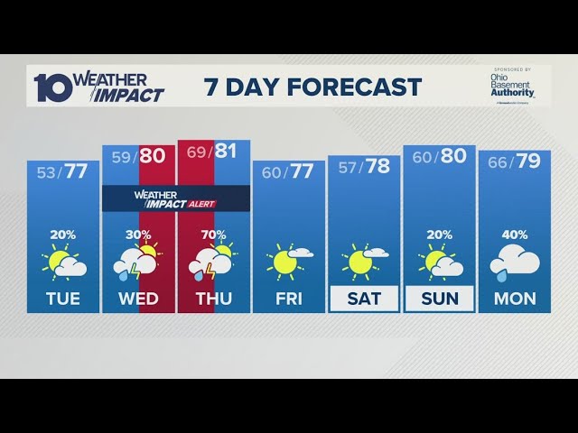
Added:Father's Day Sunday lands inside a severe weather outbreak stretching from Nebraska to the Ohio Valley. Three separate Arctic cold fronts are lined up behind Father's Day to sweep through the Midwest in 8 days. And late June temperatures could crash 20 to 30° below normal, the biggest cold swing of the summer. These three stories run together this weekend and nobody is connecting them on the cable channels tonight. This is a big deal, y'all. Omaha, Kansas City, Indianapolis, Columbus, your Father's Day cookout forecast need a weather radar backup plan. It is Friday, June 19th, and the most active June weather week in years is not done with you yet. Starting with tomorrow, Saturday, June 20th, because the Central Plains reload faster than anyone expected. A new low-pressure system is spinning up across Colorado and tracking northeast toward Nebraska and Kansas.
Nebraska, Kansas, and southwest Iowa all sit in the path of developing supercells Saturday afternoon. Strong shear and enough instability means storms that fire Saturday will have the spin to produce tornadoes. Large hail, golf ball to baseball size, is the other major threat across the Central High Plains Saturday. Salina, Dodge City, Hays, Garden City, Liberal, your Saturday afternoon carries a very real storm threat. Which means if you have any outdoor plans Saturday in Kansas or Nebraska, you need a shelter plan by noon. Here is the Saturday timeline that matters, so you know exactly when to act across the plains tomorrow. Storms begin firing along the Colorado-Kansas border between 2:00 and 4:00 p.m. Mountain Time Saturday afternoon. Which means by 4:00 to 6:00 p.m. Central Time, the most organized cells are already moving into Central Kansas. That is the danger window for Wichita, Salina, and Hutchinson, no two ways about it. Earl, my retired rancher friend up near Hot Springs, South Dakota, your Saturday looks active, too.
Isolated supercells are possible across the western South Dakota rangelands by Saturday evening. Which means get livestock to shelter before 3:00 p.m.
and keep the weather radio tuned all afternoon. Here is what makes this Father's Day weekend unlike any June weekend your family has planned in years. This is not one storm, this is three consecutive severe weather days stacked into a holiday weekend. Saturday hits the plains, Sunday hits the Midwest, and Monday hits the Ohio Valley back-to-back-to-back, which means Columbus, Louisville, and Pittsburgh all need a weather alert plan before the weekend starts. By Saturday night, the storm line sweeps east into Missouri and the southern Iowa-Nebraska border. Omaha, St. Louis, and Jefferson City all watch for damaging wind gusts Saturday evening into Saturday night, which means the Saturday evening barbecue across Missouri turns into a shelter-in-place situation fast. Storm motion is quick, 40 to 50 mph, so warning lead time could be under 15 minutes, which means you need the phone alerts on before storms arrive, not after the lights flicker out. Margaret, the retired teacher living near Springfield, Missouri Saturday evening is your window. A fast-moving line with embedded rotating segments could reach your part of the Ozarks before dark.
Full stop, get the weather radio program to your county before you sit down to dinner Saturday, and if the tornado siren sounds while you're watching the evening news, go to the basement immediately.
Now, flip to Sunday Father's Day June 21st because the storm track shifts east overnight. Springfield, Illinois, Indianapolis, Cincinnati, Columbus, and Louisville all carry a severe risk Sunday afternoon. The same corridor hit by the tornado outbreak on Wednesday takes another run at it Sunday afternoon, which means if you are already cleaning up fallen trees from Wednesday, Sunday brings another round.
Here is the detail that sets Sunday apart from Saturday that the weekend outlook is not showing clearly. Sunday's atmosphere recovers faster than models expected because the Gulf moisture return is stronger, which means Chicago, Detroit, Toledo, and Fort Wayne could see isolated supercells developing by mid-afternoon. Mark my words, the Father's Day afternoon severe threat is underrated on every forecast I've seen today.
For Father's Day Sunday, here is the hour-by-hour window you need to plan your cookout around. Morning is quiet.
Outdoor church and late breakfast are safe across the Ohio Valley before noon Sunday. Between noon and 3:00 p.m., severe storms develop across northern Indiana, southern Michigan, and western Ohio. By 3:00 to 7:00 p.m., the peak window runs from Indianapolis through Columbus toward Cleveland and Pittsburgh, which means the Father's Day cookout has a clear morning window, but needs to wrap up before noon everywhere.
After 8:00 p.m. Sunday, the line exits east in the Ohio Valley gets a few hours of clearing before Monday. Dale, my retired engineer over in Toledo, Ohio, your Father's Day has a real story attached to it. Peak storm window for Toledo runs from 4:00 to 7:00 p.m.
Sunday, right in the middle of the cookout. Honest to goodness, Dale, have the steaks done before 4:00 and the family inside before 5:00 p.m. Sunday, which means grill early and check the radar before the grandkids show up for the afternoon. Before I swing to the cold front story, I need something from you in the comments section tonight.
Tell me your city and state, especially Ohio, Indiana, Illinois, Kansas, Nebraska, and Missouri tonight. I read every single comment. Drop your location below, and I will reply with the exact timing window for your zip code this weekend. That way, nobody drives into a tornado warning on the way to Grandpa's house Sunday afternoon. Here is the number that puts the entire Father's Day weekend in perspective, plain and simple. Combined Saturday through Sunday, roughly 60 million Americans sit inside some flavor of severe weather risk. From Denver to Pittsburgh, a corridor 1,200 mi long, storms fire on consecutive days, which means the most active June on record for severe weather does not close with a quiet Father's Day. Now, here's the story that defines the rest of June, cold front after cold front after cold front. Monday, June 22nd, the first post-Father's Day cold front sweeps from Minnesota through Illinois, which means Indianapolis, Columbus, and Pittsburgh go from Father's Day storms to chilly skies in 24 hours, and that is not normal for June, no joke. That pattern belongs in October, not midsummer.
The second cold front arrives around June 24th with another round of strong thunderstorms. Kansas City, St. Louis, Memphis, and Nashville all face another severe weather round by June 24th, which means that is two cold fronts in 4 days across the central and eastern United States. Bob, the retired school teacher up in Burlington, Vermont, your late June looks unusually cold. Daytime highs in Burlington could struggle into the low 60s by June 26th and 27th. For late June in Vermont, low 60s is straight-up unusual. Usually, you're pushing 80 this time of year, which means light jackets and closed windows overnight across all of New England through the end of June.
The third cold front, and this one is the biggest, arrives around June 27th to 29th. This front tracks through the Dakotas, Minnesota, Wisconsin, and Michigan with high precipitation behind it, which means significant rainfall totals 1 to 3 inches across the Upper Midwest in the final week of June. Here is what the European model has been saying consistently for 10 days that should get your attention. Three cold fronts in 8 days after Father's Day, all of them Arctic-influenced, all of them unseasonably potent, which means Detroit, Cleveland, Chicago, and Minneapolis all run 10 to 20° below normal through June 30th. Fargo, Minneapolis, Milwaukee, and Green Bay could see overnight lows in the upper 40s by late June, which means June 26th through 30th in the Upper Midwest will feel more like late September than midsummer. Here is the remarkable temperature flip that no June in recent memory has produced across the Midwest.
Amarillo, Texas, hits 100° Saturday, while Minneapolis barely reaches 62 the same afternoon. That 38° gap across 1,100 miles is what drives every single storm this weekend. Plain and simple, the atmosphere is fighting a battle between summer heat and winter air that has no business being here. Oklahoma City, Tulsa, and Little Rock hold the 90-plus degree heat through Father's Day weekend, which means the heat dome is not going away in the south. It is just getting shoved further and further south. Helen, the retired nurse over in DC, your late June stays mild but active, not the heat dome pattern.
Washington, Baltimore, and Philadelphia all run 5 to 10° below normal through June 29th, which means the 4th of July setup for the East Coast is actually looking comfortable, no joke at all.
But, watch for brief rounds of heavy rain with each cold front passage through the DC to Boston corridor. Now, here's the thing that ties the cold fronts, the heat dome, and the storms all together tonight. The same energy pattern that drove the most active outbreak week of 2026 is now flipping into cool mode. Chicago to Charlotte, everybody who got storms Monday through Friday gets below normal cool next week, which means air conditioning units that ran full blast this week sit idle by June 25th. Now, to the long-range story that explains why this summer keeps surprising everyone month after month.
The Pacific Ocean is running 3 to 4° warmer than normal from Peru all the way west, which means El Niño, the warm water pattern that reshapes global weather, is already in strong territory.
And the water temperatures below the surface are running 5 to 7° above normal, which means that warm water pool has not fully surfaced yet. El Niño is still growing, not peaking. Honest to goodness, this is the kind of El Niño that reshapes the entire fall and winter forecast. Both the European and American models agree, this El Niño reaches peak strength by October or November. For the Gulf Coast and Southeast, more storms, more rain, more flooding potential through October. For the Northern Plains and Upper Midwest, warmer and drier than normal through the winter months.
Minneapolis, Bismarck, Sioux Falls, and Fargo could see their mildest winter in several years this year, which means snowbirds who usually flee to Florida might be able to stay home in the Dakotas this January. The Gulf of Mexico and the entire Southeastern United States run wetter than normal through spring 2027, which means New Orleans, Houston, Tampa, and Savannah track a stormier fall season than recent years.
Dale over in Toledo, your fall and winter look wetter than normal because of this El Niño signal, which means Toledo, Cleveland, and Erie all see above normal precipitation through November and December. Frank, the retired farmer outside Springfield, Illinois, two things you need to know for your property. Sunday afternoon severe window in Springfield runs from 3:00 p.m. to 7:00 p.m. Plan your Father's Day around that. And then honest-to-goodness, Frank, the late June cold means planting decisions look different than last year. Which means the second look at your fall crop schedule is worth the time before July rolls around. Here's the summary picture that most weather apps will not show you until it is too late to plan. Saturday plains outbreak Nebraska, Kansas, Missouri. Sunday Midwest outbreak Illinois, Indiana, Ohio.
Monday through Thursday three cold fronts sweep east 10 to 20° below normal. Which means Chicago, Detroit, Cleveland, and Pittsburgh go from Father's Day storms to jacket weather in 48 hours. El Niño is accelerating underneath all of this and will reshape the fall and winter patterns you are planning around. Before the final briefing tonight, I want to hear from folks across the Midwest and the South.
Are you planning a Father's Day cookout in Ohio, Indiana, Missouri, or Kansas?
Tell me your city below. I want to build tomorrow morning's briefing around the actual cities and counties watching this video. No two ways about it, your comment tonight helps me pinpoint who needs the most specific timing tomorrow.
Carol, the retired teacher down in Albany, Georgia, the Arthur aftermath cleanup wraps up this weekend. After all the rain and flooding this week, the Southeast dries out Friday through Sunday, finally. Which means damage assessment teams can work safely this weekend across Mississippi, Alabama, and Georgia. The next weather concern for Carol and all of Southwest Georgia comes with the tropical season El Niño loaded.
All right, pulling all three threads together before we close out tonight.
Father's Day Sunday severe weather outbreak from Nebraska through the Ohio Valley. Omaha Saturday, then Columbus and Indianapolis Sunday, two back-to-back outbreak days. Three Arctic cold fronts lined up behind Father's Day in eight days Monday, Wednesday, Sunday.
And late June temperatures crashing 20 to 30° below normal across half the country. No two ways about it, the most active June for severe weather in recent memory is still not finished. It closes with Father's Day storms, three cold fronts, and El Niño growing stronger under the Pacific. Nebraska and Kansas Saturday, severe window runs 2:00 to 8:00 p.m. Have shelter ready before noon. Waiting until the tornado warning sounds is too late across the fast-moving storm corridor Saturday.
Ohio Valley and Midwest Sunday Father's Day severe window opens at noon. Morning cookout is safe. If severe warnings start dropping before 2:00 p.m. Sunday in Indiana or Ohio, take them seriously immediately. Gulf Coast and Southeast, the weekend is clear. The perfect time to complete Arthur's damage cleanup. New England and Mid-Atlantic cool and quiet through the weekend with active rainy spells late next week. Upper Midwest ranchers and farmers, three cold fronts with heavy rain arrive by June 26th.
Watch the June 27th cold front, especially it carries the heaviest precipitation of the month. Here's the bottom line. The outbreak week of June 16th through 18th is closing, not over.
Father's Day Sunday brings it back for the Ohio Valley and Midwest one final time before the pattern shifts. Three cold fronts then sweep through in 8 days, the coolest late June in years east of the Rockies. An El Niño growing in the Pacific tells you this summer is not done surprising you, mark my words.
Next briefing comes tomorrow morning at 6:00 a.m. Eastern with the Father's Day forecast built around your city. Omaha, Springfield, Indianapolis, Toledo, Columbus, keep the radar app open all weekend long, and do not say nobody warned you when the siren sounds during the Sunday afternoon Father's Day cookout.
Related Videos
Monday evening forecast | June 15, 2026
WBNS
384 views•2026-06-15
Monday evening First Alert Weather with Darren Peck 6/15/2026
cbssf
662 views•2026-06-16

Clouds build up tonight as we track a storm threat for Thursday
NBC10Boston
2K views•2026-06-17

Just One magnetic field power, two light start with Armechar • Dc Armechar
DcArmechar7
14K views•2026-06-17

What a Massive Blue Iceberg Actually Looks Like?
QuickLearnGeography
100 views•2026-06-18

Chicago Morning News at 7 a.m. - Monday, Jun. 15, 2026
FOX32Chicago
942 views•2026-06-16

The Terrifying Physics of High Blood Pressure
fleshandwonder
1K views•2026-06-15
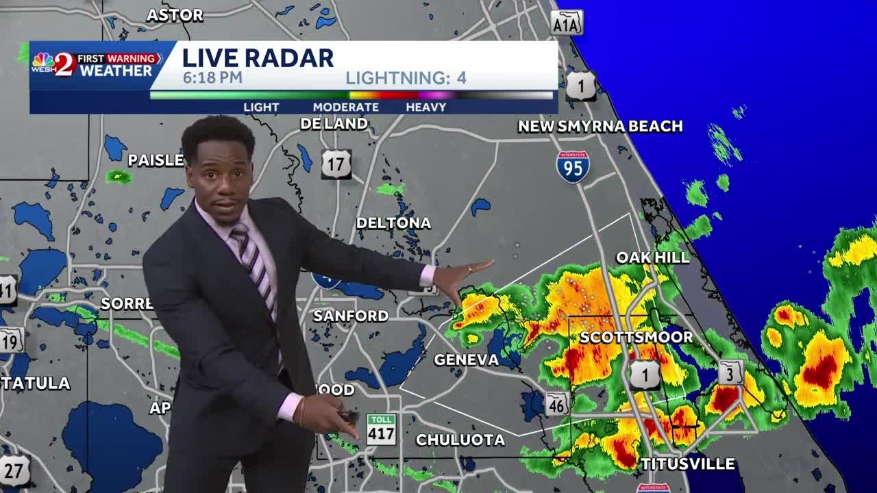
Strong And Severe Thunderstorms Surge Across Central Florida To Finish the Workweek | Stormy Week...
WESH
806 views•2026-06-19


